 VI
VI


-
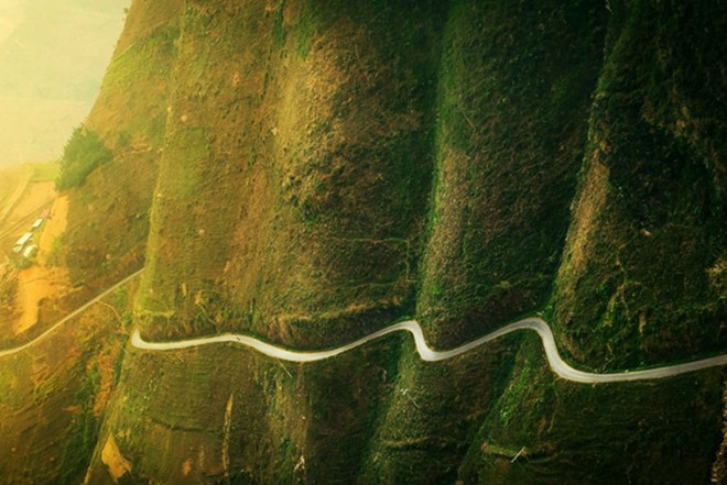
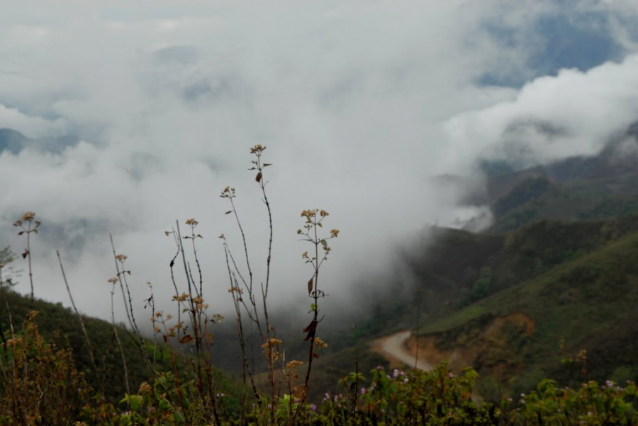
Ma Pi Leng Pass, Ha Giang
This treacherous mountain pass, approximately 20km long, crosses the summit of Ma Pi Leng Mountain, which is 2,000m high, connecting Meo Vac with Dong Van. This section of the pass is famous for its winding roads that snake from one mountain to another.
In the Quan Hoa dialect, Ma Pi Leng literally means "horse's nose." However, figuratively, the name refers to the treacherous nature of the mountain peak, where the slope is so steep that a horse would be breathless trying to cross it, or the peak is as vertical as a horse's nose.

The road that runs through Ma Pi Leng Pass, known as the Happiness Road, was built by tens of thousands of volunteer youth from 16 ethnic groups across 8 provinces in northern Vietnam between 1959 and 1965. Along the pass, workers had to suspend themselves on ropes between cliffs for 11 months to complete the construction.
Since 2009, the Ma Pi Leng mountain region has been recognized as a national scenic site. Accordingly, the Ma Pi Leng pass is considered a unique geological and landscape heritage area; the pass summit is one of the most beautiful panoramic viewpoints in Vietnam, and the Nho Que River gorge is one of the most unique tectonic valleys in Vietnam.

-
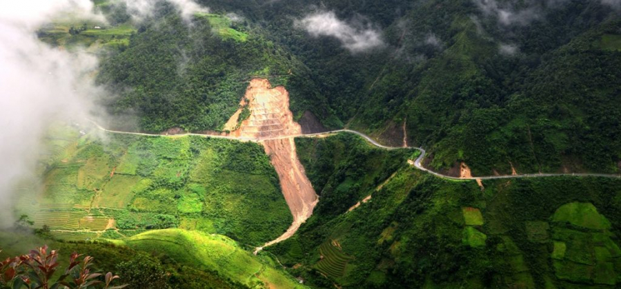
O Quy Ho Pass
This pass holds the record for length in the Northwest mountainous region (50km) and is also one of the most treacherous and majestic mountain passes in Vietnam. Located on National Highway 4D, which cuts across the Hoang Lien Son mountain range, the pass connects the two provinces of Lao Cai and Lai Chau, with its summit at an altitude of 2,000m marking the boundary between the two provinces.
The name O Quy Ho originates from the mournful cry of a bird, associated with a legend about the unfulfilled love story of a young couple. Additionally, O Quy Ho Pass is also known as Hoang Lien Pass, because it crosses the Hoang Lien Son mountain range, or Cloud Pass because the summit is covered in clouds year-round.


Its altitude, ruggedness, and length have earned O Quy Ho Pass the unofficial title of 'King of Passes in Northwest Vietnam'. The summit of O Quy Ho Pass, nestled amidst towering mountains and clouds, is also known as the Gate of Heaven. In colder years, the pass summit can be completely covered in ice and snow.
Not only is it treacherous, but in the past, this pass was also associated with stories of mythical tigers lurking to prey on travelers, so very few people dared to cross it. Today, the pass has been upgraded considerably and has become a fairly busy route for vehicles.
-
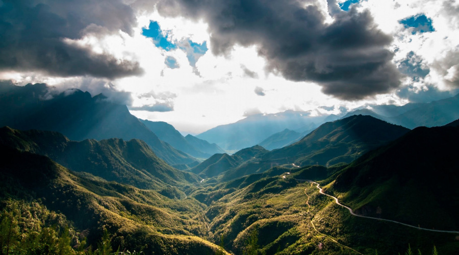
Pha Din Pass
Pha Din Pass is a 32-kilometer-long mountain pass located on National Highway 6, partly in Phong Lai commune, Thuan Chau district, Son La province, and partly in Toa Tinh commune, Tuan Giao district, Dien Bien province, with its highest point at 1,648 meters. The name Pha Din Pass originates from the Thai language, meaning 'Heaven and Earth', implying that this is the place where heaven and earth meet.
Pha Din Pass is renowned for both its treacherous terrain and its breathtaking scenery. Midway up the pass, it's often shrouded in mist, while scattered villages dot the foothills. However, as you approach the summit, you can barely see any villages; instead, you'll find only the deep blue sky and majestic mountains blending seamlessly into one.

In recent years, the project to renovate and upgrade National Highway 6, the Son La-Tuan Giao section, has been completed. The bypass road around Pha Din Pass, built along the mountain slopes of the secondary pass peaks on the left side of the old National Highway 6, at an altitude of about 1,000m (200-400m lower than Pha Din Pass), has reduced traffic on the route through Pha Din Pass, and the pass is now only suitable for adventurous tourists.
During the resistance war against the French, Pha Din Pass was one of the vital routes for transporting weapons, ammunition, and food supplies to the Viet Minh's Dien Bien Phu campaign, enduring fierce bombing raids by the French air force. This made Pha Din Pass a symbol of bravery, with over 8,000 young volunteers "determined to die for the Fatherland."
-
Khau Pha Pass
This is the longest pass on National Highway 32, stretching over 30km. It is also one of the most winding and steep mountain passes in Vietnam.
The pass is located in the border area between Van Chan district and Mu Cang Chai district of Yen Bai province, passing through many famous landmarks such as La Pan Tan, Mu Cang Chai, Tu Le, Che Cu Nha, Nam Co... at an altitude of 1,200 m to 1,500 m above sea level.
The view from Khau Pha Pass is most beautiful during the rice harvest season (September - October). When the rice on the Tu Le terraced fields turns golden yellow, it's the time when many adventurous tourists conquer the pass to admire this stunning natural scenery.
Besides the endless terraced rice fields, along the winding mountain pass of Khau Pha, there are also ancient forests that retain their pristine character, preserving many rare species of flora and fauna.
.jpg_1.jpg")