 VI
VI


Mount Chu Yang Lak is located along National Highway 27 near Lien Son town, Lak district, within Chu Yang Sin National Park, Dak Lak province. The peak of Chu Yang Lak, approximately 1,700 meters high, is one of the best cloud-watching spots in the Central Highlands.
One day at the end of the year, we took an overnight bus from Ho Chi Minh City and got off at the Yang Tao intersection on National Highway 27 at dawn, gathered for breakfast, and stopped at the market to stock up on food.
At 7:30 AM, the guide team, led by Mame – a tall, dark-skinned young man from an ethnic minority group – appeared. We had to ride on a tractor from National Highway 27 to the foot of the mountain.
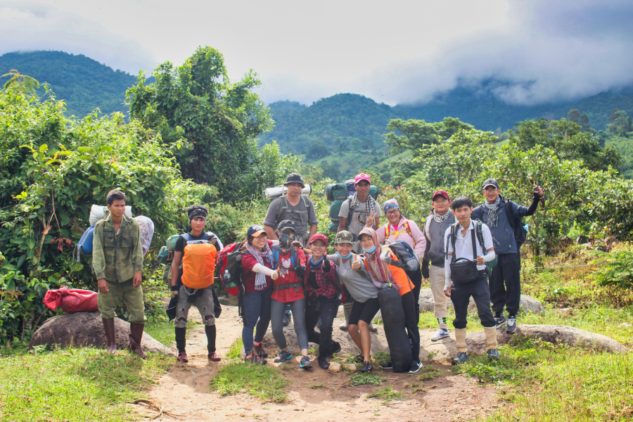
Before climbing the mountain, their clothes were clean and their spirits were high.
Crossing through rich forest areas
Within the mountain range of Chu Yang Sin National Park, Chu Yang Lak peak, though not very high, offers a panoramic view overlooking Lien Son town and Lak Lake. The vegetation here is also very rich. Along the way, we successively passed through low-lying shrub forests, pine forests, and tropical primary forests at different altitudes. Therefore, although there was "only one slope," we were quite excited by the constantly changing scenery, which was never boring.
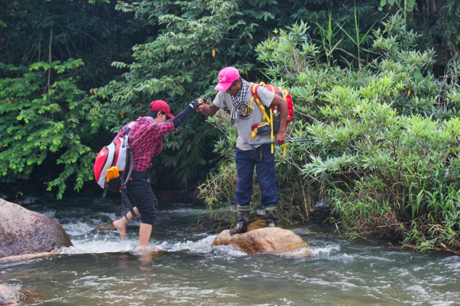
Cross the stream at the foot of the mountain.
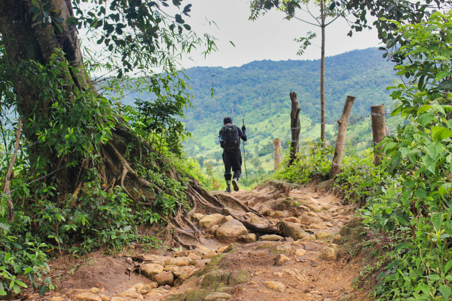
Starting on the slope
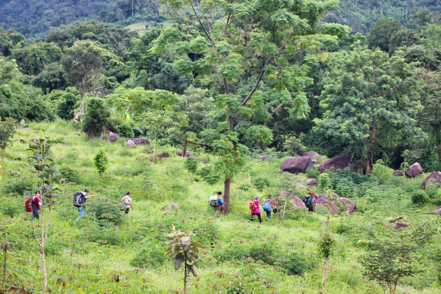
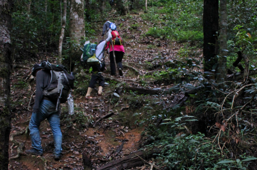
Crossing through the low-lying bushes…
But the slopes in Chu Yang Lak were truly unpleasant; they just kept climbing, quickly tiring our legs. It wasn't until midday that we finally got past the area of low-lying bushes. The girls in the group exclaimed, rushing towards the cluster of bright yellow flowers beside the trail. "Those are Finger Flowers, Finger Leaves!" Mame quickly warned. Oh, it turns out that in the forest, most poisonous things are... very eye-catching.
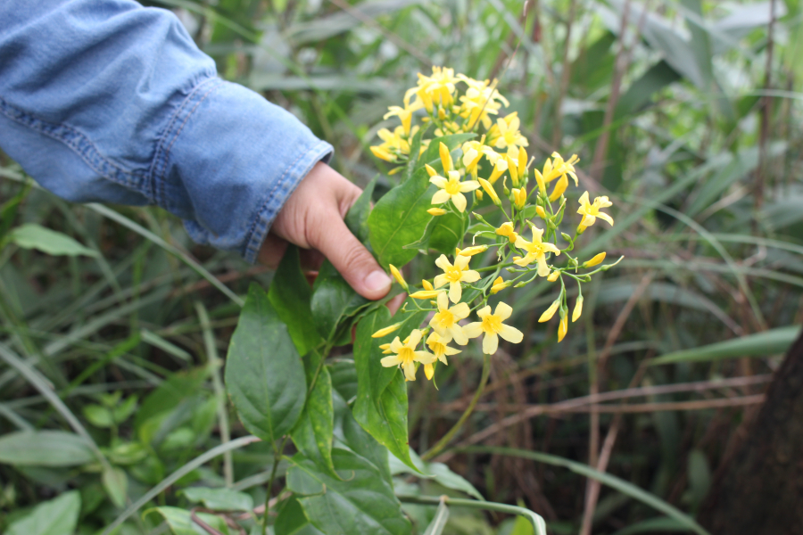
Roadside Strychnos nux-vomica bushes
After resting for lunch under a large tree, we continued our ascent. Reaching the mixed forest halfway up the mountain, the slope became quite slippery due to damp, decaying leaves. The sound of heavy breathing drowned out conversation, but then everyone gasped as the group approached the pine forest: a corner of Lake Lăk appeared beneath the sparse pine canopy.
…there's only one slope.
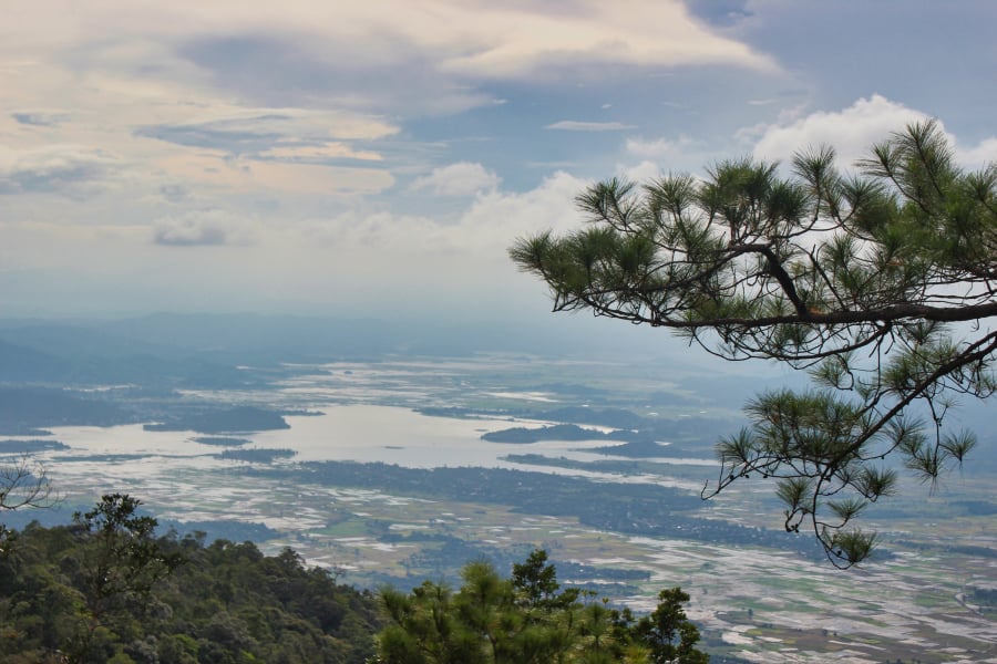
A corner of Lake Lăk under the pine forest canopy.
In the late afternoon, we emerged from the pine forest. Mame pointed to the mountain peak ahead – which resembled a hump on a cow's back – and said, "The warm-up phase is over; now it's time for a strenuous climb, everyone."

The girls groaned, "Oh my God, we don't even get past the warm-up until 4 PM?"
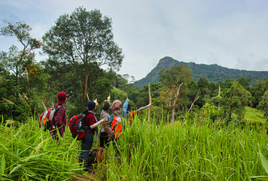
Destination: that "cow's hump"
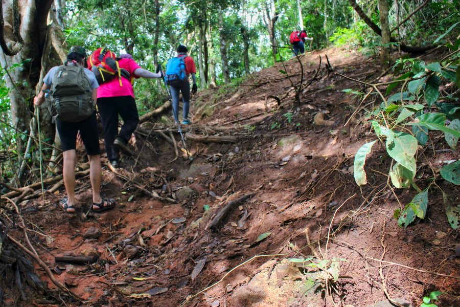
Mame urged everyone to hurry as we were already behind schedule. We had to climb several steep slopes before we could even begin to enter the primeval forest area.
Late in the afternoon, the forest is quite dark because the tree canopy blocks out the last rays of sunlight. The ground is steep and tangled with tree roots, making it very difficult to discern the path. Without a local guide, one would certainly get lost.
The path sloped steeply, and tree roots crisscrossed the ground.
As darkness fell, the group split up. Mame led the "stronger team" to the campsite first to prepare the meal, while another member of the group led the way, guiding the "weaker team" behind. I had to use my flashlight to light the way for the others clinging to tree roots to climb up.
While resting in the darkness, anyone who had snacks would take them out to eat to lighten their backpacks. Around 7:30 PM, the last group arrived at the rest stop, located right at the foot of the "cow's hump".
The rainforest was incessantly drizzling. A late meal of grilled chicken, grilled meat, and a pot of porridge in the cold rainforest was incredibly delicious. Because of the exhausting day's journey, we quickly retreated to our tents and hammocks to sleep, saving our strength for the climb to the summit of the "cow's udder" the next day.
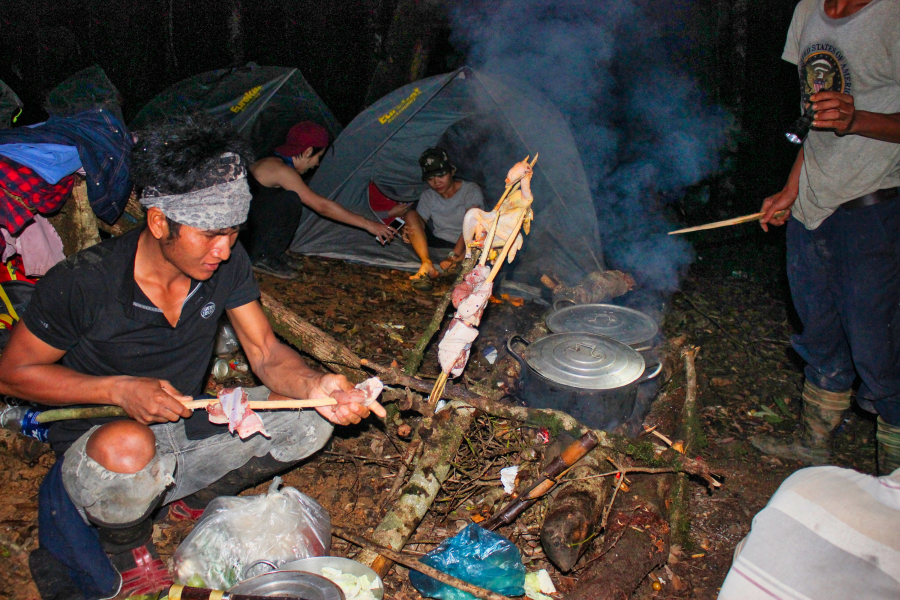
Preparing for dinner
Submerged in a sea of clouds
Early in the morning, fog enveloped the patch of forest where we had set up camp, and the faint blue smoke rising from the campfire made the landscape even more ethereal. Everyone huddled around the fire, eating instant noodles and warming their hands. Then, leaving all our belongings at the hut, we began climbing the "cow's hump"—actually a massive rock formation rising from the mountaintop.
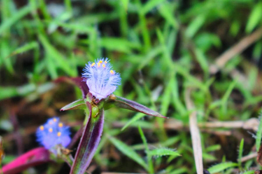
Flowers and grasses along the road
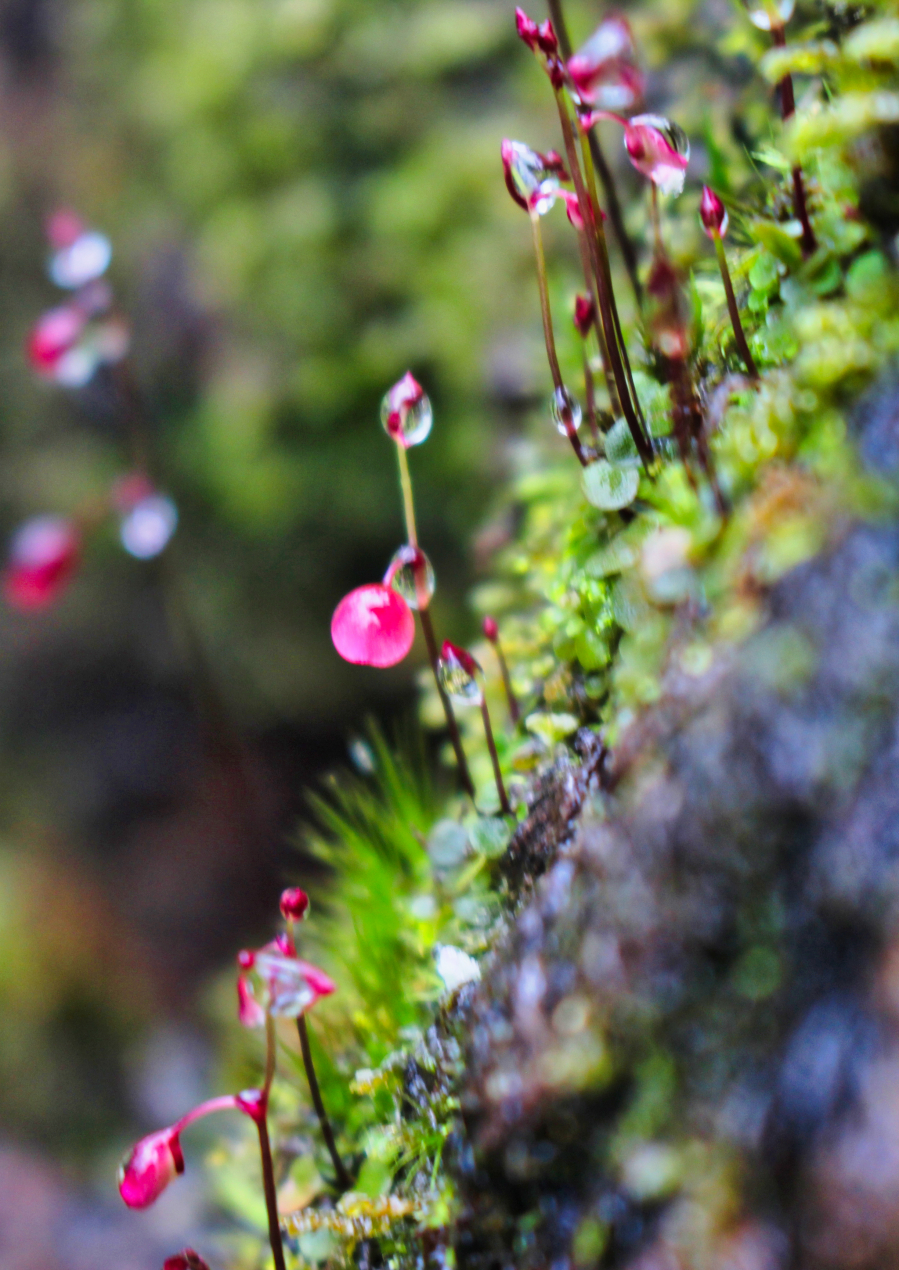
Tiny flower buds, heavy with morning dew, cling to the cliff face.
The rock formation was about a hundred meters high, but we had to climb a winding path to make it less steep. Clouds shrouded the entire route, soaking everyone's faces.
When we heard Mame yell from ahead, "We've reached the summit!", everyone was a little bewildered, because… we were in the middle of a thick cloud, and we could only see blurry outlines of things ten meters apart.
All I could see around me were clouds and more clouds.
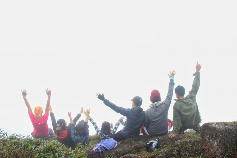
The feeling of being in a space densely enveloped by cold, damp clouds is indescribable. Everyone sat down on the edge of a rocky ledge at the summit, waiting for the clouds to part so they could gaze at the plains below.
Then, in an instant, strong winds blew a hole through the cloud mass covering the mountaintop. Everyone gasped in delight as a glimpse of the plain below appeared through the gap the wind had created. It was a brief moment, but the emotions lingered in each of us.
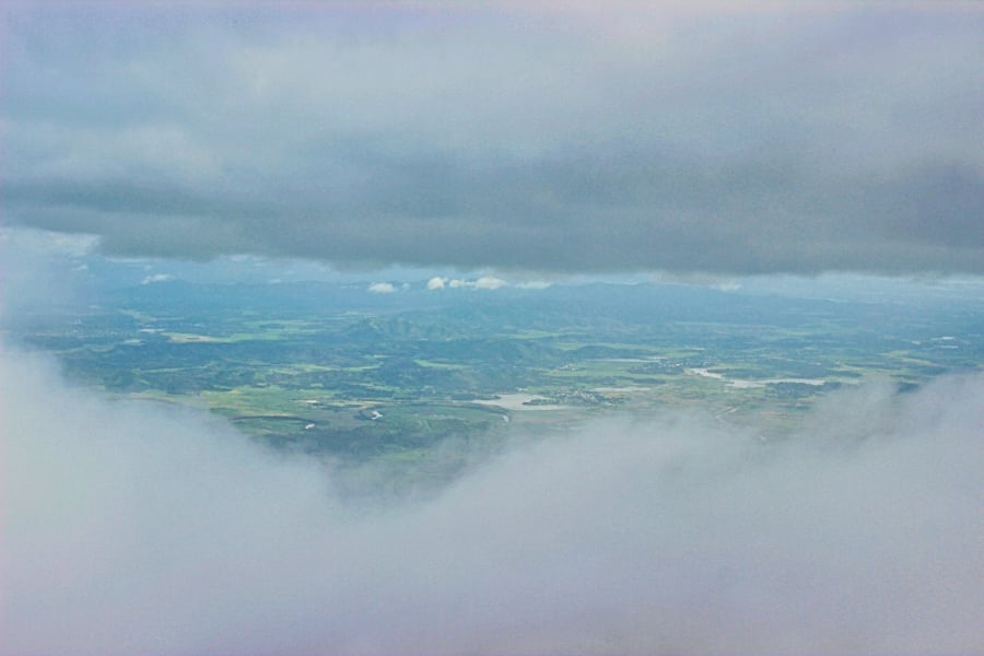
A glimpse of the plains below briefly appeared through the "hole" in the sea of clouds.
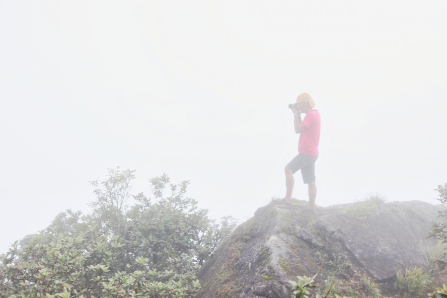
Taking advantage of the opportunity to "get to work"
Clouds blanket the summit of Chu Yang Lak
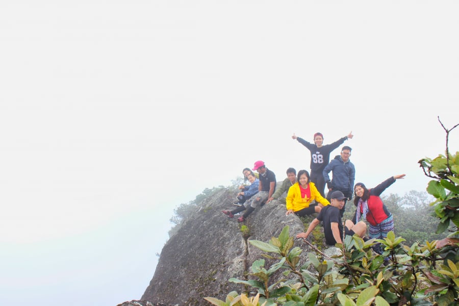
After half an hour on the summit of Chu Yang Lak, we descended to pack our bags and clear away the trash before heading down the mountain. Because it had rained all night, Mame led the group down a different, gentler route – which was, of course, much longer – to avoid danger.
It wasn't until dusk that we finally reached the foot of the mountain, bringing to a close a very tiring but rewarding journey.
Some things to note
- To travel to and from the destination, you can take the Hoa Liem bus from the Eastern Bus Station (Ho Chi Minh City), departing at 10 PM and getting off at the Yang Tao intersection on National Highway 27 (around 5 AM the next morning). The return trip is the same.
- Although the summit of Chu Yang Lak is located on the edge of Chu Yan Sin National Park, permission to climb the mountain is still required from the National Park Management Board.
- The road to the summit of Chu Yang Lak has many very steep sections, so avoid going on rainy days as it will be very difficult and dangerous. The best time to go is from October to May of the following year.
- You should prepare gloves with a non-slip surface to increase grip, as there will be many steep sections where you will need to use both your leg and arm strength to move forward.