 VI
VI


There's no road to talk about getting lost on.
We set off from Quy Nhon city, traveling north along National Highway 1A for about 50 km to Cat Tai commune, Phu Cat district. Mr. Do, our guide, was waiting for us at the meeting point. After parking our motorbikes at a friend's house, we eagerly grabbed our backpacks and headed straight up the mountain.
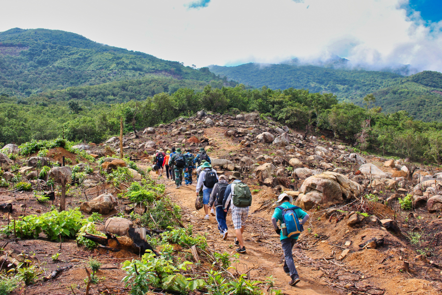
After traversing a vast, gently sloping cashew orchard, the group finally began their actual climb up the mountain. Dense trees, tangled vines, and thorny bushes, along with large and small rocks scattered haphazardly across the slopes, made it almost impossible to find a clear path.
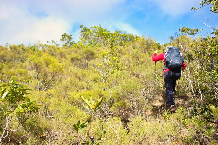
Begin heading towards the Ba mountain range.
Beyond the cashew orchard, the mountain begins to climb.
A moment of rest halfway up the mountain.
When asked "how to avoid getting lost?", Mr. Do just smiled without answering. Climbing quite high up the mountainside, we came across several charcoal kilns emitting thick smoke. Passing through this area, everyone felt chest tightness due to the very high concentration of toxic carbon monoxide in the air.
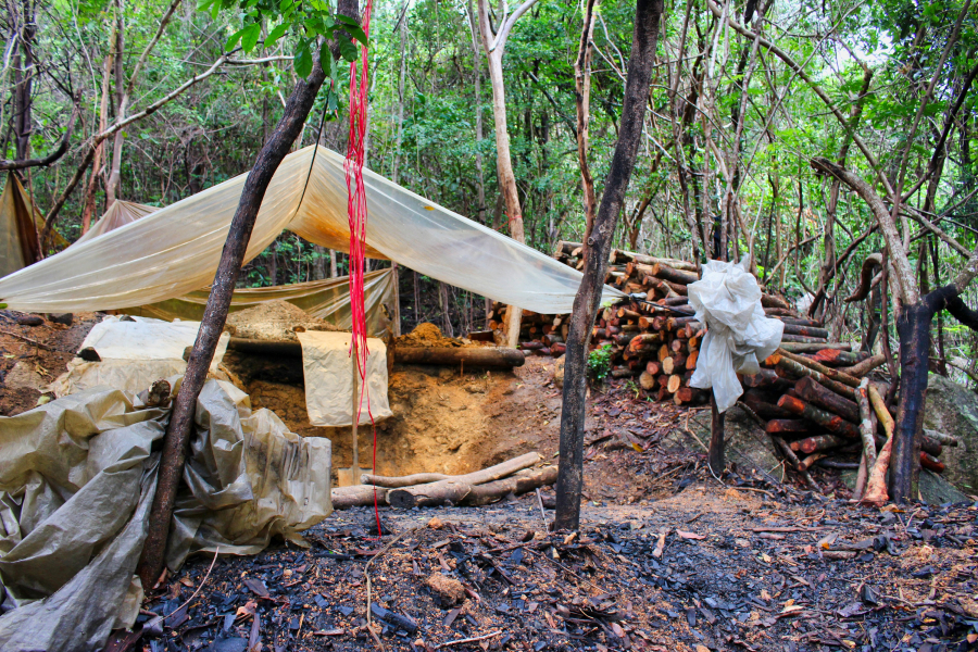
A charcoal kiln on the mountain
After passing several charcoal kilns, we stopped at a small stream to have lunch and lighten our load. At this point, Mr. Do calmly said, "There are no roads here, so how could we get lost? Actually, we... get lost frequently in the mountains. But we always end up back where we know the place, and then... we're not lost anymore."
We were still bewildered when he continued, "Those charcoal kilns are the reason we often get lost. People usually leave trail marks on tree trunks when they go into the forest, and the charcoal makers cut down trees in different places every day. So sometimes we mark the path up the mountain, and a few days later when we come down, the mark is gone."
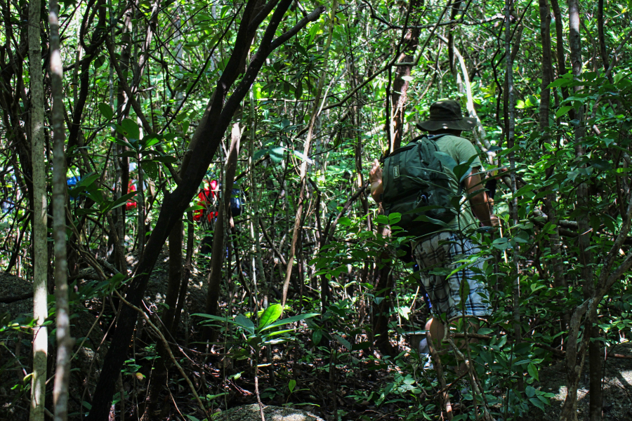
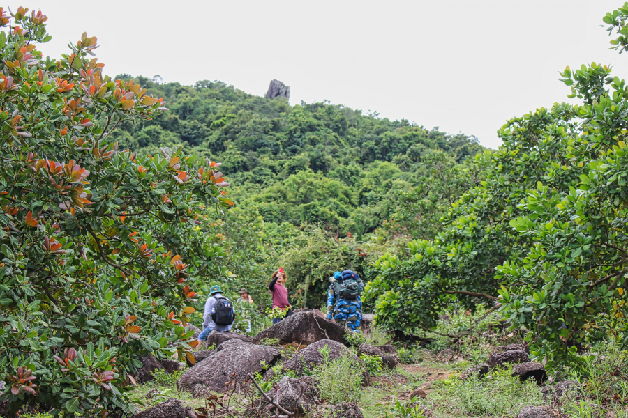
Go through the bushes.
After resting, we set off again. The trees were densely packed, and we had to use knives to cut through the vines and thorns to make a way through. Mr. Do chuckled, "It's true that I've never been on this path before, but you won't get lost. Once you reach the ridge, you'll find your way."ThunderstormThat's the mountain ridge. We started to find this kind of "exploratory" way of going interesting, so no one asked any more questions; we just followed him.

Fragrant Artemisia annua fields on the mountain slopes.
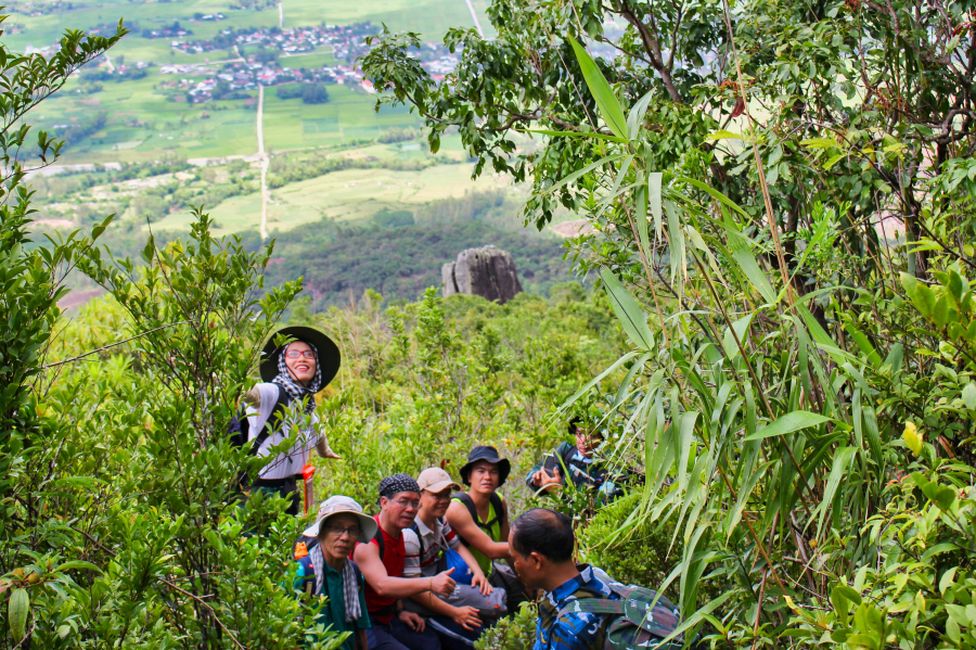
Late in the afternoon, we finally made our way up to the ridge, where there were vast fields of Artemisia annua – a type of conifer with many branches and a mild, pleasant fragrance – a plant that in many places is bundled together to make brooms for sweeping yards.
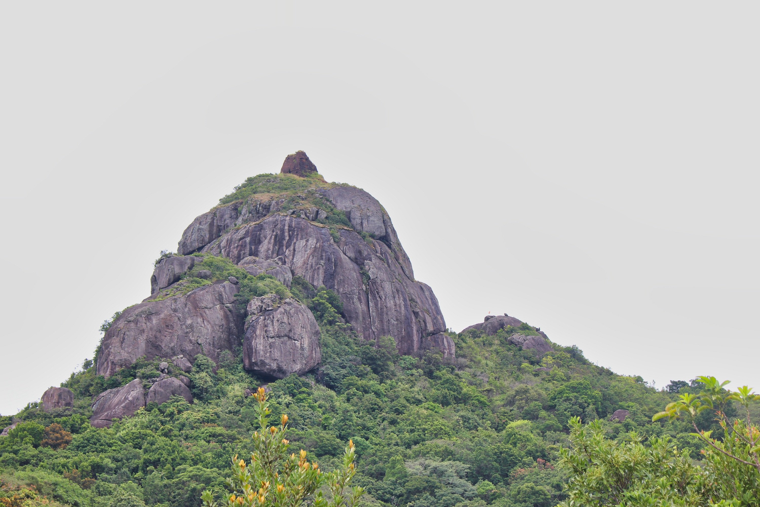
We quickly located Hon Chuong. After about half an hour of walking along the mountain ridge, getting quite close to Hon Chuong, Mr. Do turned into a large, flat grassy area near a small stream, and the whole group set up camp there.
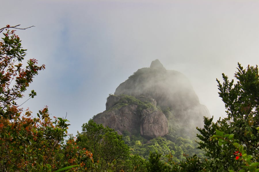
Clouds swirl around Hon Chuong Island in the late afternoon.
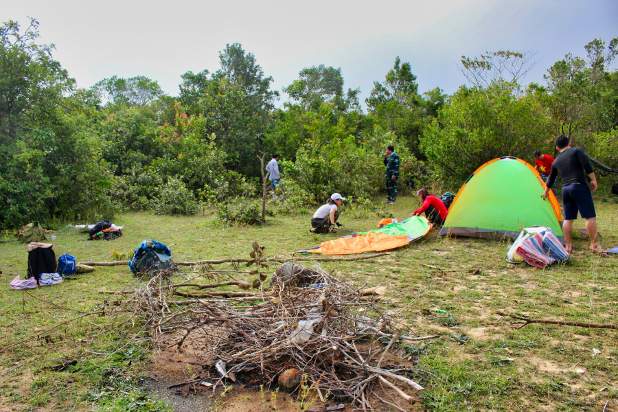
Set up tents, gather dry firewood to prepare a campfire.
One rather special thing: at the summit of Hon Chuong Mountain lies the remains of an ancient Cham tower that has never been mentioned by French archaeologists in their lists of ancient Cham relics in Central Vietnam. The ruined ancient tower is our destination on this trip to Ba Mountain, but that's for tomorrow.
Exploring the ancient Hon Chuong tower - a failed mission.
Dinner of grilled chicken and chicken porridge passed comfortably in the mountains. Everyone went to bed early, but stories about the mysterious Hon Chuong Tower and the ancient gold prospectors who roamed this area continued until quite late at night.
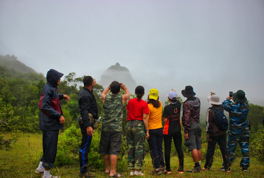
It rained last night, so the early morning was shrouded in mist. We even forgot to eat breakfast, and instead spent our time taking photos of Hon Chuong Island hidden in the fog – it was truly magical.
The Bell Island is shrouded in mist in the early morning.
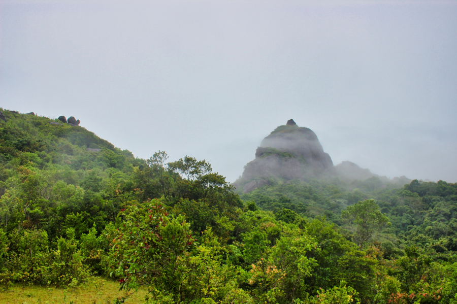
Thin clouds drifted lazily across Hon Chuong Island.
After a hurried breakfast, we only took our machetes and a 20-meter-long rope, as thick as our thumbs, and headed straight for Hon Chuong. Crossing through the sparse, low-lying bushes, it only took about 15 minutes to reach the foot of Hon Chuong. From a distance, it looked fine, but up close, the rock formation was… enormous and incredibly steep. Half of the rock behind was a ravine; we spent an hour trying to find a viable way to climb it, but couldn't find a way up, so we had to climb onto a lower rock right next to Hon Chuong.
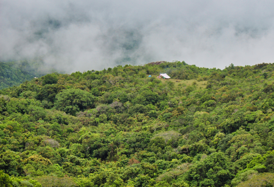
Looking towards the camp, mist enveloped the hillside beside it.
We sat atop a nearby rock formation, with a clear view of the ruins of the brick Cham tower atop Hon Chuong. The feeling was hard to describe. There was regret for not reaching our ultimate goal, but also a touch of joy at being here, after an exciting journey, so close to a site that has hardly ever been mentioned in archaeological records.

We climbed onto the low rock nearby and got a closer look at Hon Chuong Island.
Around mid-morning, it started to drizzle, so we returned to the hut to pack our belongings, clean up the trash, and descend the mountain.
We will definitely return to Hon Chuong Island at a more suitable time, when we are better prepared in terms of time and transportation.