 VI
VI


The difference from the guide
Every stepBell IslandHaving failed to find a way up the tower, everyone knew how difficult it was to climb that massive rock. However, this time we found a guide who was committed to helping us reach the tower. Even so, we still met and agreed that the safety of each individual was paramount; if even a few members of the group could reach the top of Hon Chuong, that would be a great achievement.
Instead of camping the night before, this time we also strengthened our resolve by setting off and returning on the same day, to avoid carrying tents and food, and to focus our energy on finding a way to reach the summit of Hon Chuong.
As planned, we left Quy Nhon at 4:00 AM, heading towards Phu Cat in two 7-seater vehicles. After having breakfast at Chanh Danh village market in Cat Tai commune, Phu Cat, we stopped at a cafe to wait for our guides. When they arrived, we set off at 6:45 AM to enter the mountains.
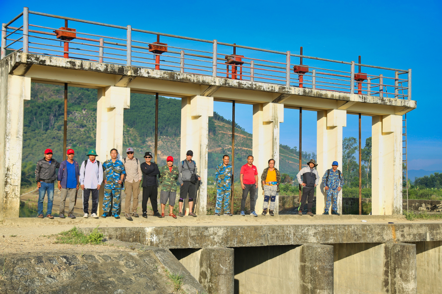
Just before departure, at Suoi Luc dam, Chanh Danh village
After several years, the beginning of the road remained the same: a narrow, winding concrete path uphill through a large cashew orchard. Luckily, besides the two guides, there were two more locals, friends of one of the men in the group. They had three motorbikes, so they diligently went up and down the road, carrying both luggage and passengers to save time.
A moment of rest at the end of the cashew garden.
After passing the cashew orchard, the motorbikes were left behind, and the whole group trudged up the mountain. The scenery was almost the same as before. About an hour from the start, we arrived at Hon Chong - where there is a large rock on the mountainside - and stopped to rest as we had done before.
Mr. Khoa is standing on Hon Chong.
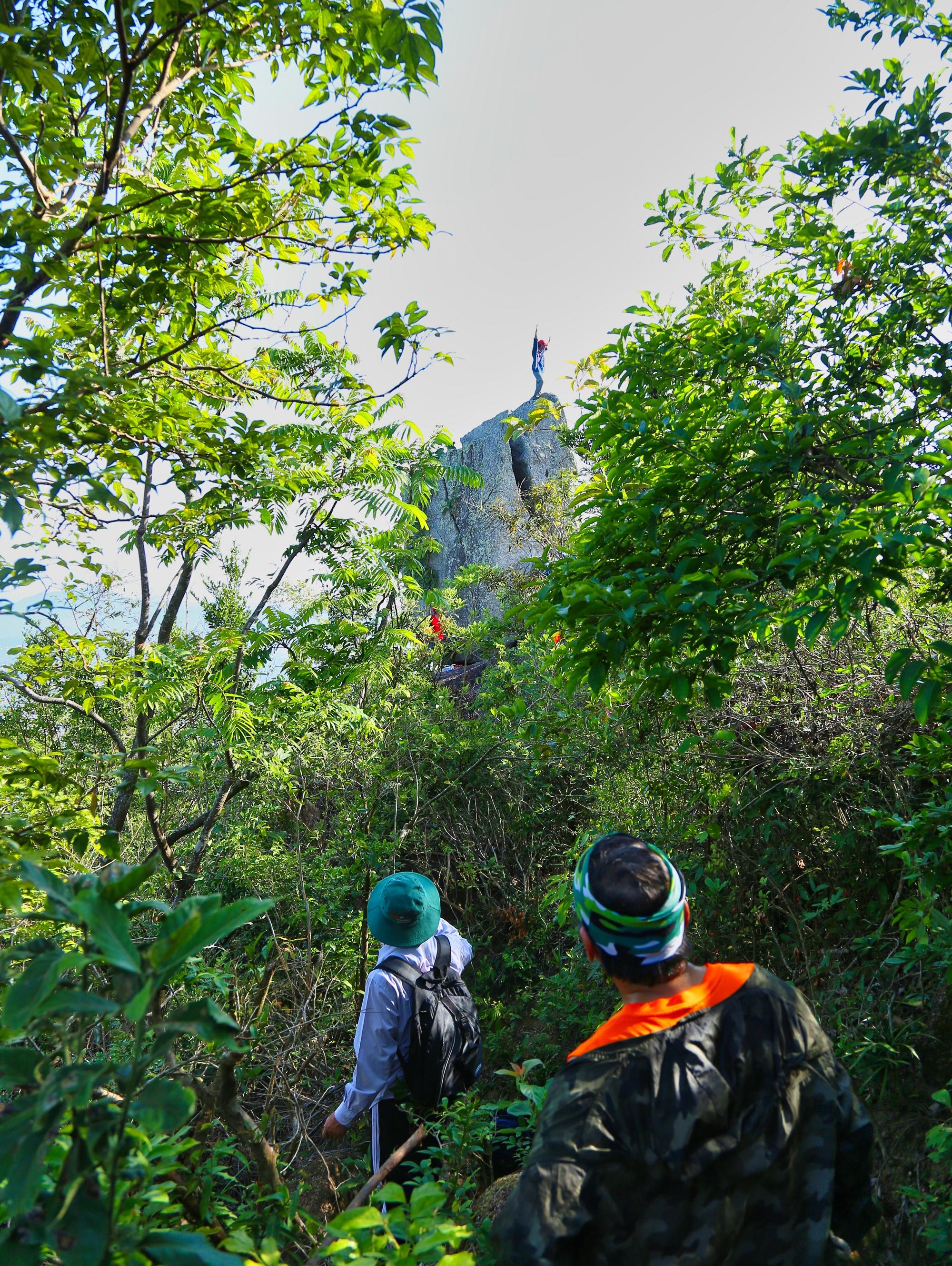
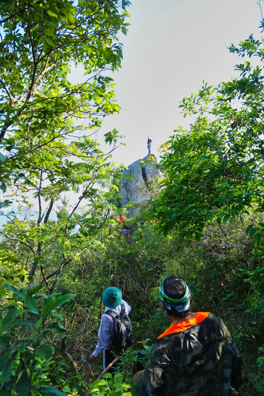
After some time, the landscape along the mountain trail changed considerably. In some places, the trees were denser, while in others, the forest was more open. A short distance past Hon Chong, in an area with sparser trees, Hon Chuong suddenly appeared, both near and far.
Hon Chuong Island appears along a sparsely forested stretch of road; it looks far away, but it's still quite a distance to reach.
Our guides this time – Khoa and Cuong – were both locals. Khoa was around 40 years old, dark-skinned and small in stature, while Cuong was much younger, also dark-skinned but very strong and muscular. The essential equipment we had prepared was a nearly 200-meter-long roll of parachute cord, complete with all the necessary buckles and safety harnesses. The cord and buckles weighed about 20 kg; the night before we set off, the four of us had to take the cord to the streets of Quy Nhon to unroll it and fold it into smaller sections, both to prevent tangling and to make it easier to carry in our army backpacks.
Anyone who tries on a safety backpack shakes their head and sticks out their tongue – because it's heavy, bulky, and unbalanced when stuffed in. However, for Ho Cuong, it's no big deal. He calmly slung the backpack over his shoulder and strode confidently along the rocky, steep mountain path.
This time, Khoa and Cuong led us along the same route as before to the abandoned charcoal kiln, then took a "shortcut" - which we only realized we had taken that morning when we went to buy sugar, not a shortcut.

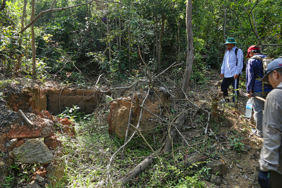
The charcoal kiln from last year has now been abandoned.
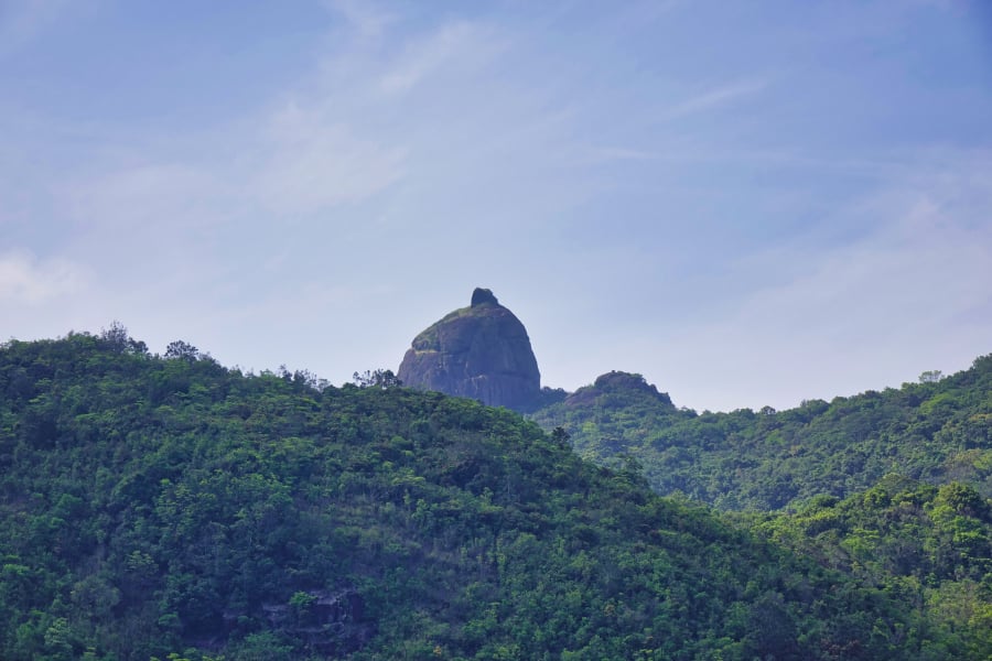
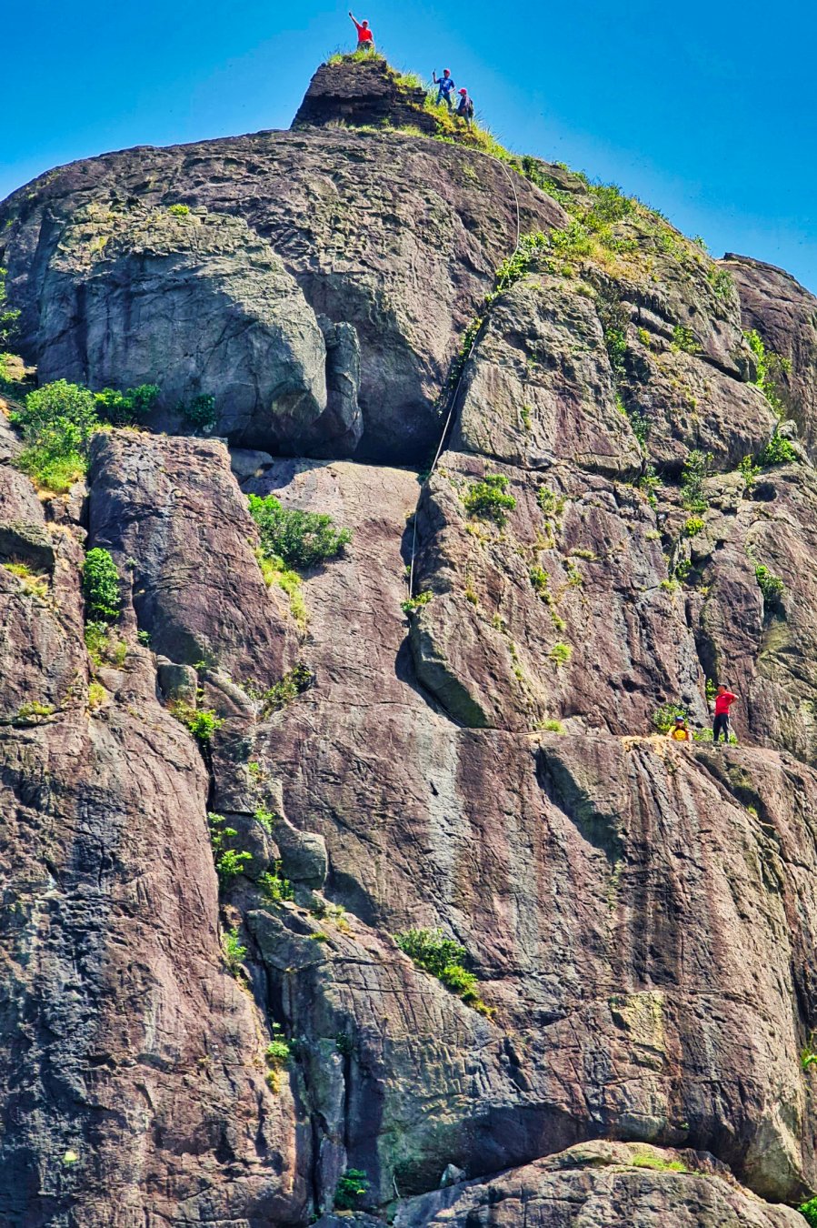
Because our destination was Hon Chuong, everyone hurried along the way, rarely stopping for rest or other activities. At 10:30 AM, we arrived at the foot of Hon Chuong – a bizarre rock formation rising about 50 meters with a mysterious, dilapidated ancient tower on top.
Conquer Hon Chuong, the ancient tower gradually comes to light.
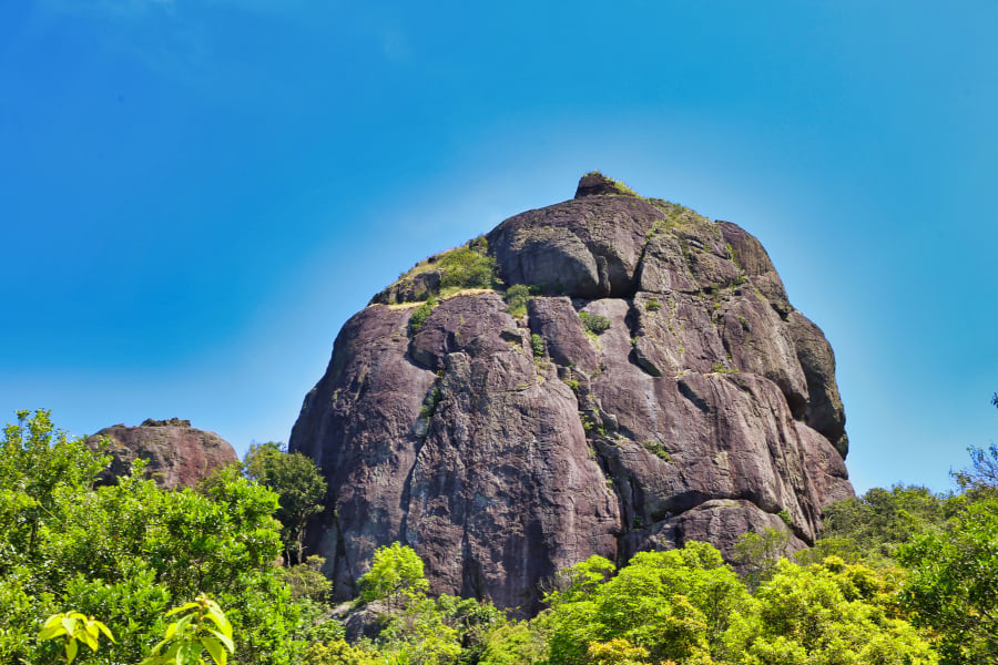
Bell Rock and the ruined tower on top
The group made their way through the forest, reaching the foot of the colossal rock formation, finding a cool spot to rest and have an early lunch. Lunch was self-provided; everyone brought whatever they liked to eat. They all contributed to share, including rice, sticky rice cakes, sausages, chicken, and more.
While everyone had just finished eating and were resting and discussing how to climb to the top of Hon Chuong, Khoa quietly left the group. Then, by chance, one of the men went to a tree branch to hang his backpack, looked up, and shouted in a thick local accent: "Wow, he's climbed to the top of Hon Chuong!"
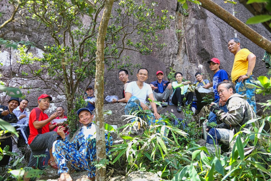
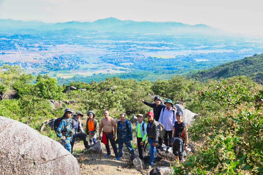
Gathering for an early lunch at the foot of Hon Chuong, the oldest member of the group was 65 years old.
The atmosphere immediately became heated; in fact, some people were still skeptical about whether the guide could climb the tower – because only when they reached the base of Hon Chuong and looked up did they realize how difficult it was, and they didn't even know where to begin.
We started leaving our luggage behind, taking only water, and began climbing the base of the rock formation to reach the highest point. No one noticed where Khoa had started crawling from, and now he was trying to get closer to everyone to grab the safety rope and pull himself up to find a place to tie it.
From our lunch spot, we followed the base of the giant rock formation clockwise, using smaller rocks and trees as support, and climbed about 10 meters before reaching a deep ravine. Above us, Khoa also cautiously made his way down to the exact spot where we had stopped, but about 5-6 meters above us.
The guide rope was thrown up, Khoa lowered one end, we tied the main rope so Khoa could pull it up, find an anchor point above, and after about 15 minutes, Cuong attached the safety equipment to himself and the rope, demonstrating to us how to cross the cliff using the safety rope.
Then, he climbed down again to help us fasten our safety harnesses and properly attach the safety hooks to the ropes. And the first person made it up the cliff, to where Khoa was waiting above.
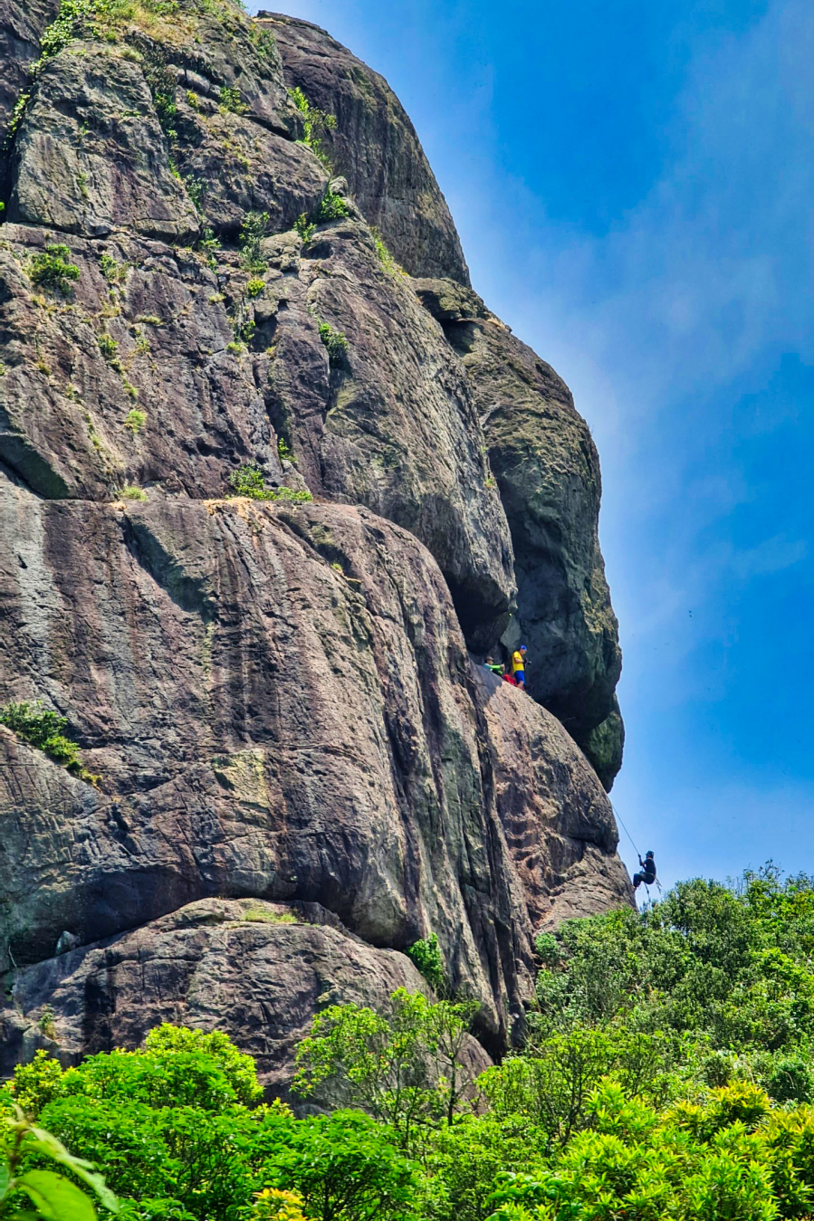
Climbing the cliff (first leg) using vines… just like in the movies (Photo: Spring Sunshine)
Generally, the journey to the summit of Hon Chuong can be divided into 3 stages:
- Climb the first cliff using vines to reach the first ledge where you can rest.
- The cow crawled through a very narrow and low crevice in the rock to reach another, wider ledge next to it, which was more convenient for climbing higher.
- Continue climbing the cliffs to the tower from the second assembly point.
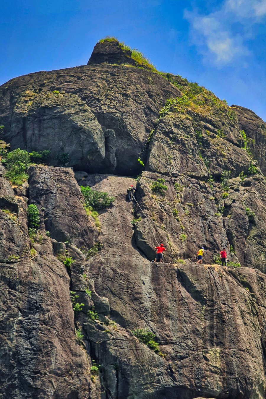
Three people successfully completed the second leg of the journey. Khoa is wearing a safety harness as he ascends Hon Chuong mountain (Photo: Nang Mua Xuan).
Out of the 13 people in the group (not including Khoa and Cuong, who were the guides), 5 made it through the first leg, 3 through the second, and only 1 person, Le Thanh, managed to complete the third leg with the help of Khoa and Cuong to reach the summit of Hon Chuong and the tower. Two people stopped after completing the second leg due to altitude sickness.
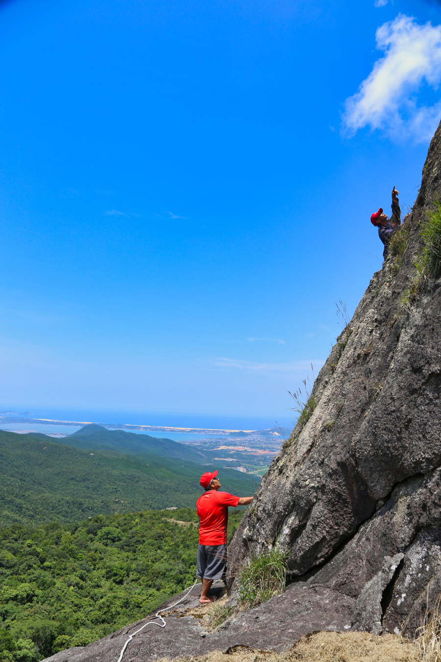
At the second rocky outcrop, in the distance are the Dam Thuy lagoon and the De Gi estuary, and further still is the East Sea. From the summit of Hon Chuong, the panoramic view in all directions is even more impressive.
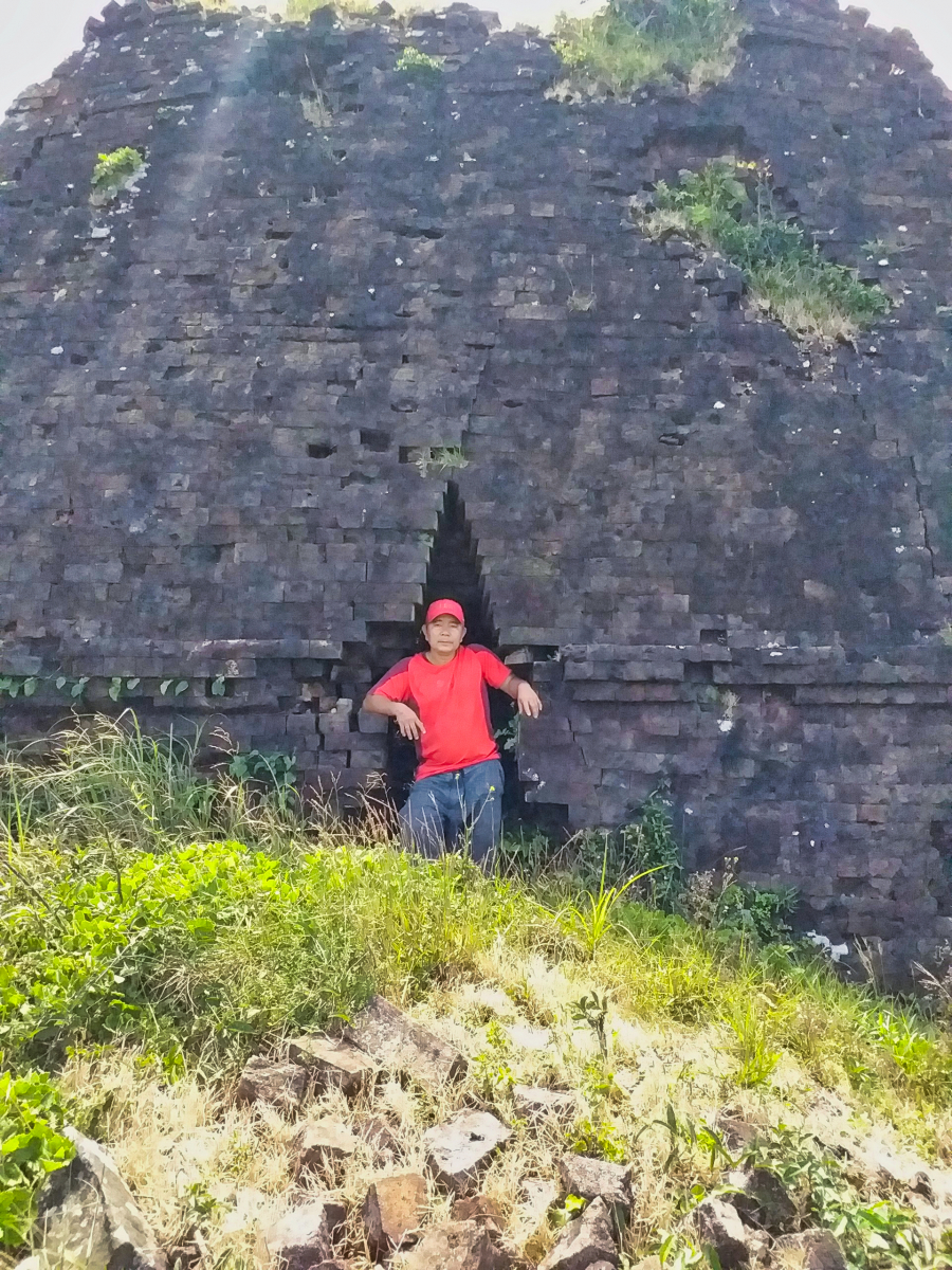
Mr. Le Thanh stands in front of the tower on the summit of Hon Chuong, with a jumble of old bricks in the background (Photo: Le Thanh)
The moment our group members reached the summit of Hon Chuong and the ancient tower, 12:30 PM on April 18, 2021 (Photo: Nang Mua Xuan)
According to Thanh, the only person in the group who managed to reach the summit of Hon Chuong, the area at the top of the rock formation is approximately 60 meters wide.2The tower is slightly tilted. Built directly on rock, the ancient tower has east-west sides measuring approximately 3 meters, north-south sides approximately 4 meters, and walls about 0.8-1 meter thick, tapering gradually towards the top.
The eastern wall has lost three rows of bricks at the top and is the only side with a small, spear-shaped doorway – a common feature in other Cham towers built around the 12th-13th centuries in Binh Dinh. The western wall (the back of the tower) suffered the most severe erosion – about two-thirds of its height has been lost. The tower itself is completely devoid of any carvings; the bricks from the western wall were scattered outside when the erosion occurred. Inside the tower, vegetation grows tall up to the top of the walls, but observation reveals nothing else inside.
The east, south, and north walls of the tower are still about 3.5 meters high, but the roof – which was mentioned in very few documents – has completely disappeared. On top of Hon Chuong, bricks are scattered everywhere, and next to the ancient tower there is a carefully piled-up old clay mound, whose surface has cracked over time.
Mr. Thanh – the second person from the right – was one of the members who reached the summit of Hon Chuong.
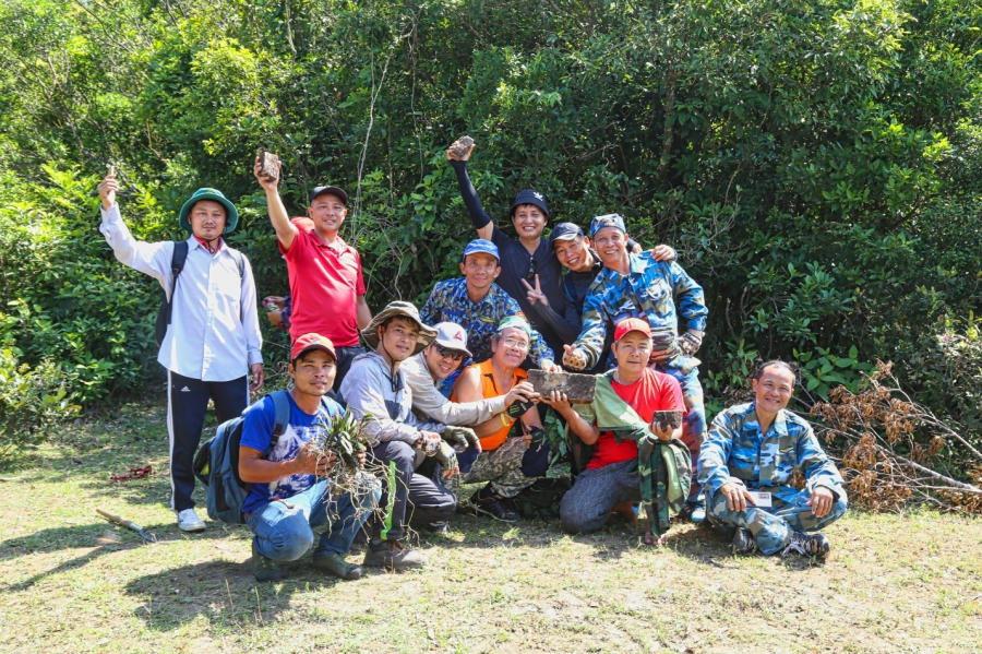
Although only one member (not including the two guides) made it to the summit of Hon Chuong, the entire group was very happy to have overcome the challenge of nature. Hopefully, in the future, official survey teams from cultural and historical management units will continue to research and clarify the mysteries of the ancient tower on the summit of Hon Chuong.
Through this trip, we believe that many local people have indeed set foot on the summit of Hon Chuong before, and although it is difficult and dangerous, it is not too difficult or impossible to do.