 VI
VI


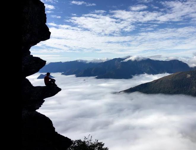
The rocky outcrop on the summit of Pha Luong
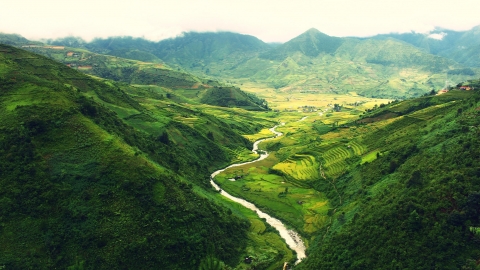
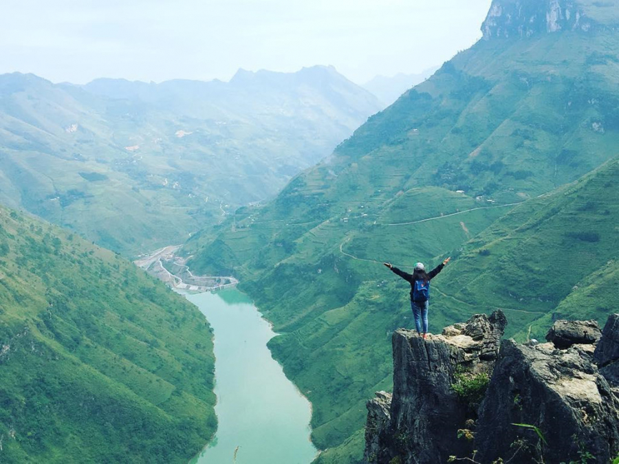
Moc Chau is famous for its dreamy and vibrant scenery characteristic of the Northwest mountains and forests. Besides visiting tea hills and strawberry gardens, adventurous travelers can also conquer the rocky peaks of Pha Luong mountain – considered the highest point in Moc Chau.

Pha Luong mountain peak is located about 70 km from the center of Moc Chau, in Tan Xuan commune, Chieng Xuan district. Besides its majestic scenery, the summit of Pha Luong also features a rocky outcrop with a panoramic view; simply sitting there, you can gaze upon the picturesque landscape of Son La amidst the white clouds.
A not-too-large but protruding rock formation juts out from the mountaintop, with white clouds drifting below and rolling hills and lush green forests in the distance... This place is also a cloud-hunting paradise that you can't miss when visiting Moc Chau.
If you want to conquer this Instagrammable rock formation, you should go in a group and in the morning because the journey up to the summit and back down will take about 6 hours. Also, choose comfortable and sporty clothing to ensure safety while admiring the view.
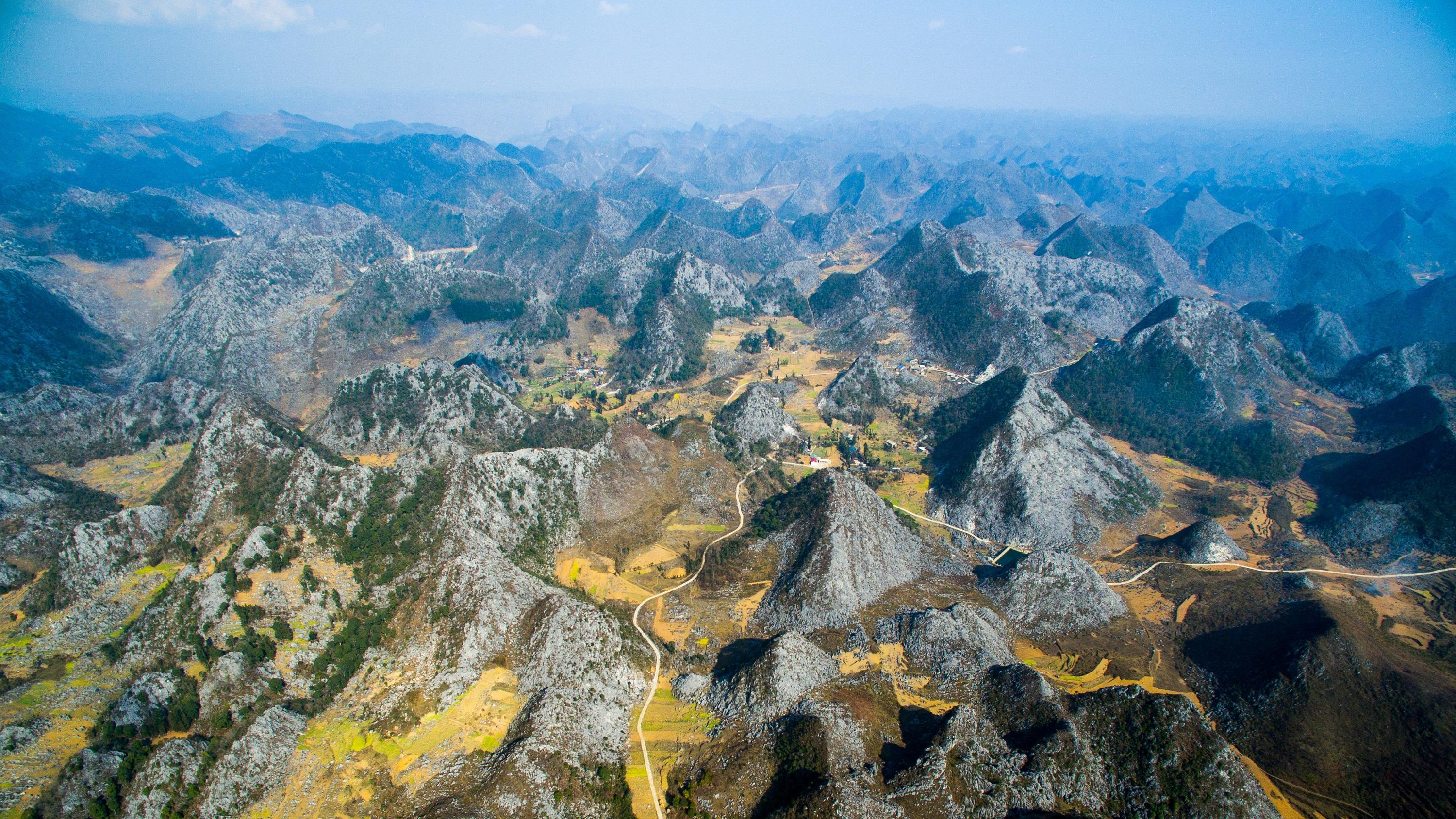
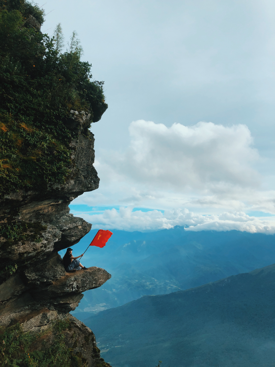
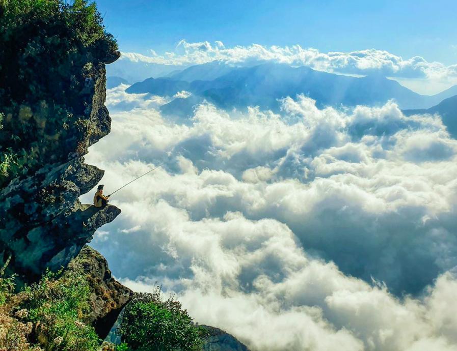
Rocky outcrop on Ma Pi Leng Pass
If Pha Luong is a mountain, then Ma Pi Leng is a famous mountain pass, one of the "Four Great Mountain Passes" of the northern mountains. From the top of this pass, you can gaze down at the crystal-clear, turquoise waters of the Nho Que River.

This is also why the Ma Pi Leng pass has become an unmissable stop for tourists visiting Ha Giang. Especially the area in the middle of the pass - where there are rocky outcrops offering panoramic and romantic views of the highlands at the northernmost point of the country.

The Ma Pi Leng Pass is approximately 20 km long and features many rocky outcrops offering stunning views. However, only the rocky outcrops in the middle of the pass provide the most panoramic views and the closest vantage point to the Nho Que River. Standing here, you can enjoy a 360-degree view of the majestic and vast landscape of Ha Giang, especially the breathtaking sight of the tiny Nho Que River gently winding below.

However, because the rock formations are made of stacked slabs of rock lacking cohesion and stability, the local authorities have fenced them off to ensure the safety of all visitors. If you want to take photos of the stunning mountain pass and the Nho Que River from above, you can choose other rock formations or stand along the railing of the pass for safety.
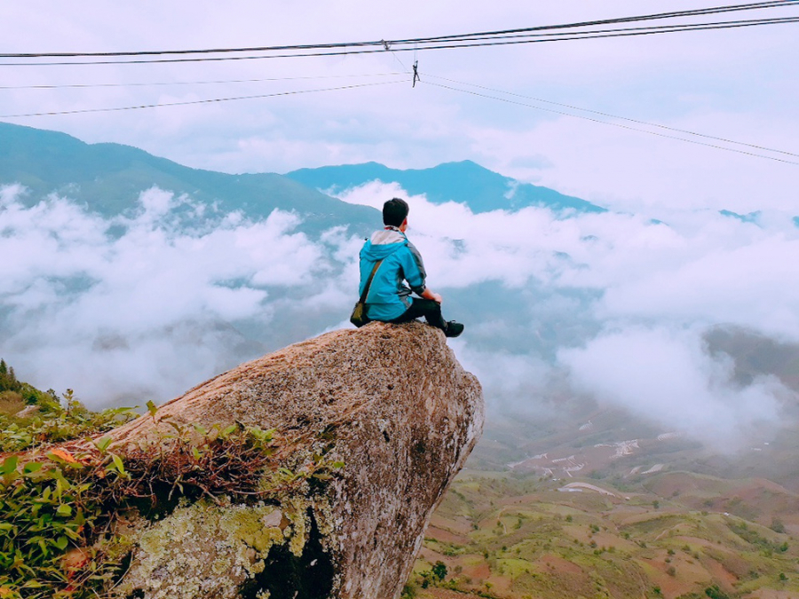
Turtle Head Rock Formation in Ta Xua
The rocky outcrop on Ta Xua mountain is also a fantastic spot for young people who love adventure. This rocky outcrop is located on the Ta Xua mountain range, in Cong village, Tram Tau district, Yen Bai province.
Compared to the rock formations in Son La and Ma Pi Leng, this one is also very beautiful and offers spectacular photo opportunities. This rock formation is often called the "turtle head" because a large slab of rock protrudes from the center, resembling the head of a turtle.

To conquer the rocky peak at the summit of Ta Xua, you have to spend about 4 hours climbing the mountain, crossing steep slopes and treacherous paths likened to a dinosaur's spine. However, upon reaching the summit at an altitude of over 2,000 meters, any tired legs will find the hardships worthwhile.
Surrounding the rocky outcrop on Ta Xua mountain are swirling white clouds, a deep blue sky, and dense forests. Although considered not a particularly dangerous spot, taking photos here still gives you a sense of precariousness due to the vast, expansive space all around.
The surface of the Turtle Head rock formation is quite flat and easy to walk on; however, don't risk sitting on the outer edge if you're afraid of heights. Additionally, the climb to the summit of Ta Xua takes a considerable amount of time, so plan your trip carefully and avoid reaching the summit after dark, as the descent at night will be very difficult.
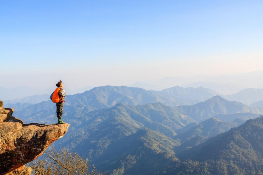
Rocky outcrop on the summit of Lao Than - Y Ty
Mount Lao Than, with an altitude of over 2,800 meters, is located in Phin Ho commune, Bat Xat district, Lao Cai province. Lao Than is a place frequently visited by professional trekkers, while ordinary tourists rarely come here because the journey is quite arduous and time-consuming.
However, ever since images of this Instagrammable rock formation in Vietnam appeared on social media, many young people have started visiting because of its pristine beauty and sparse human footprints.
Locals say this rock formation is also called "rock wave" due to the structure of the slabs and cliffs perched precariously on the edge of a precipice. That's why photos of this rock formation are so breathtaking, giving a sense of ethereal beauty suspended in mid-air, with the sky and clouds stretching into the distance.
Standing on the summit of Lao Than or on a rocky outcrop, you will take in the picturesque scenery of Y Ty. These include mountains lying peacefully amidst the clouds and valleys a vibrant green with newly harvested rice.
Although Lao Than peak is located at an altitude of nearly 3,000 meters and the trek to the summit takes about 4 hours, tourists who have trekked there all agree that it is a wonderful journey.