 VI
VI


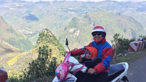
Moc Chau - Ta Xua
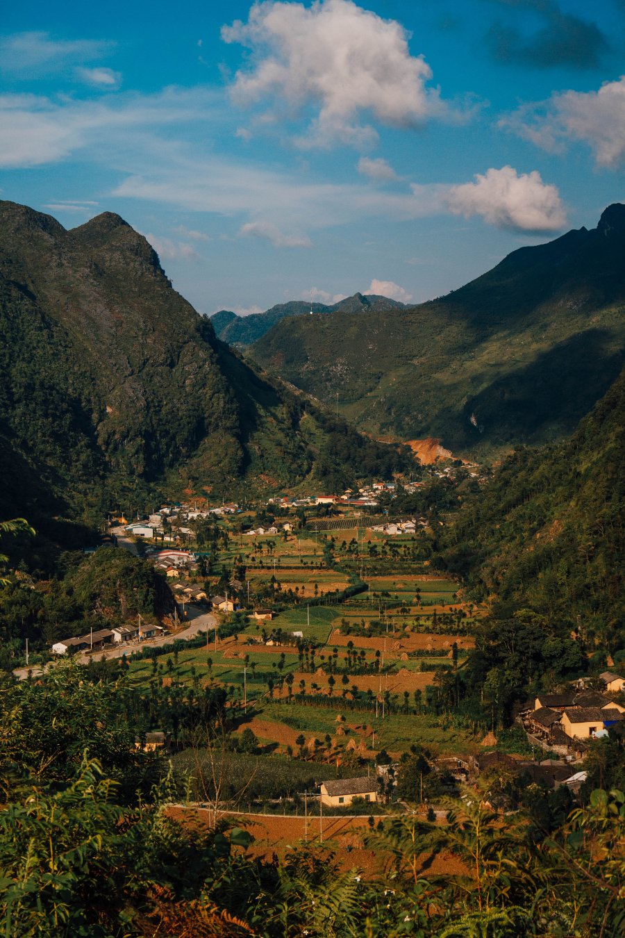
The route I chose to begin my Northwest Vietnam journey was Hanoi - Moc Chau - Ta Xua - Hanoi. Located 300km from Hanoi, the Moc Chau plateau is blessed with a cool climate year-round, making it an ideal destination for those who want to escape the sweltering heat of the capital and find a peaceful and refreshing place.
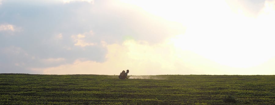
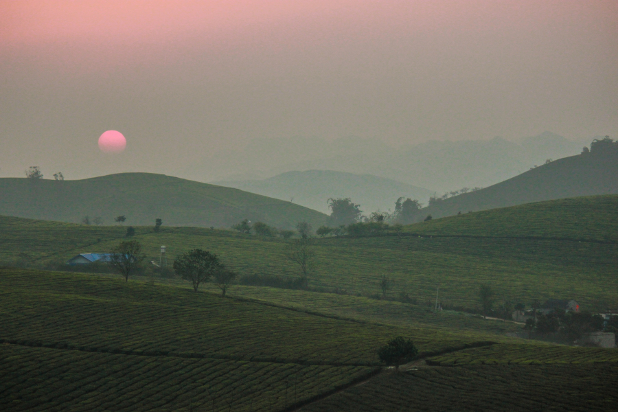
In summer, Moc Chau is adorned with the refreshing green of its tea hills. Perhaps nowhere else in Northern Vietnam is tea cultivated on such a large scale as in the Moc Chau plateau. The image of the lush green tea plantations, winding and stretching from one hillside to another, has become a trademark of this region, an endless source of inspiration for travel enthusiasts and adventure seekers like myself.
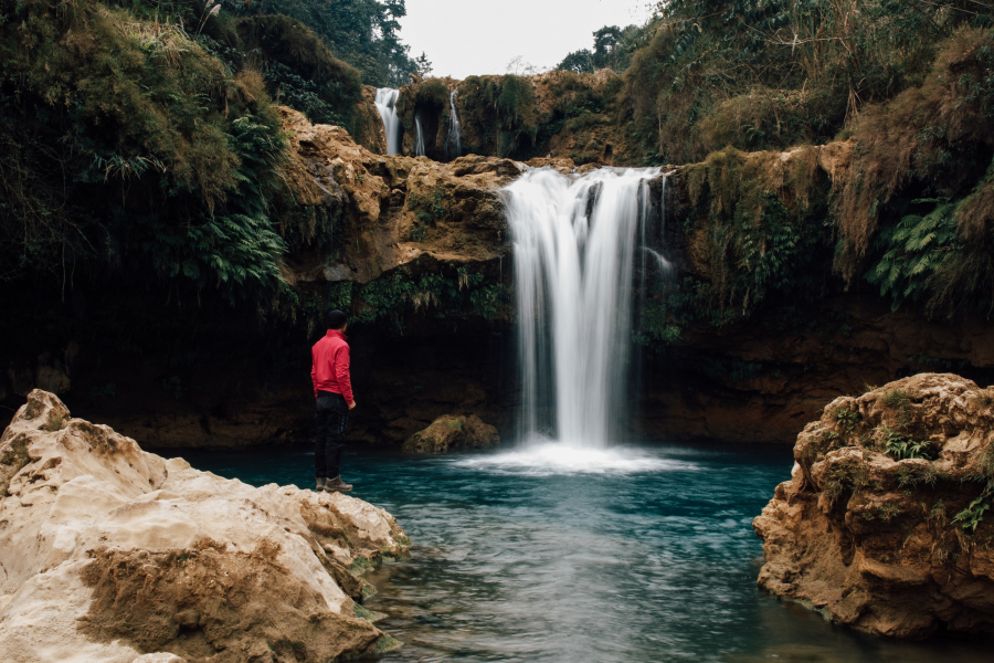
To get a closer experience to nature, I decided to explore Chieng Khoa Waterfall. Located just 20km from the center of Moc Chau town, Chieng Khoa Waterfall is nestled amidst majestic, unspoiled nature. I had to walk a short distance through bushes, grassy areas, and rice fields before I could admire the first tier of the waterfall. The waterfall has many tiers, each with fairly deep pools of clear, turquoise water. Just immersing myself in these cool streams seemed to make all the heat and discomfort of the summer day disappear.
Returning to town after an incredibly enjoyable experience, my choice was a homestay located on the prairie to fully enjoy the fresh air and immerse myself in nature.
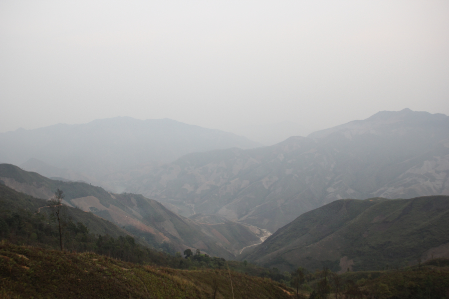
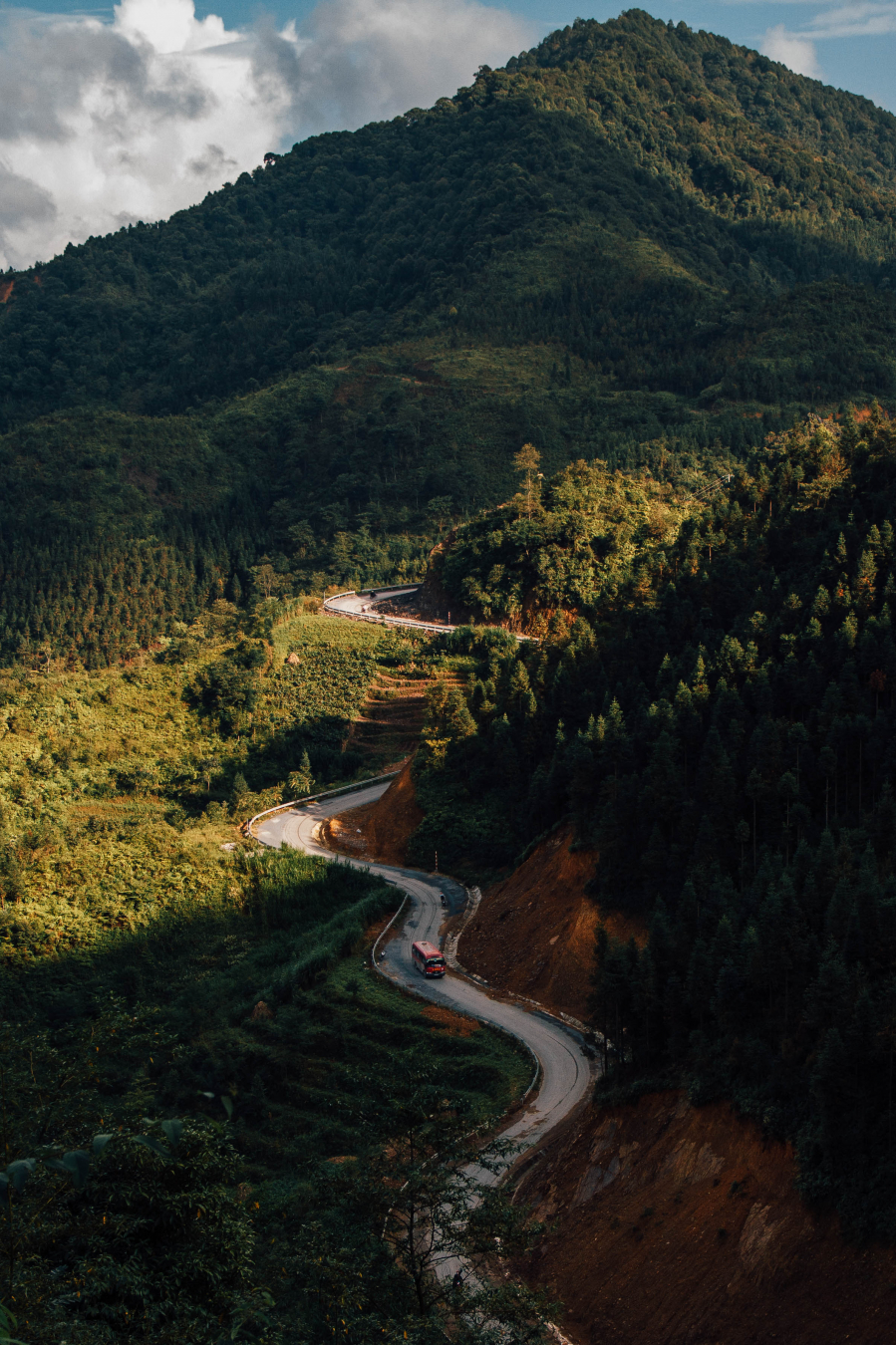
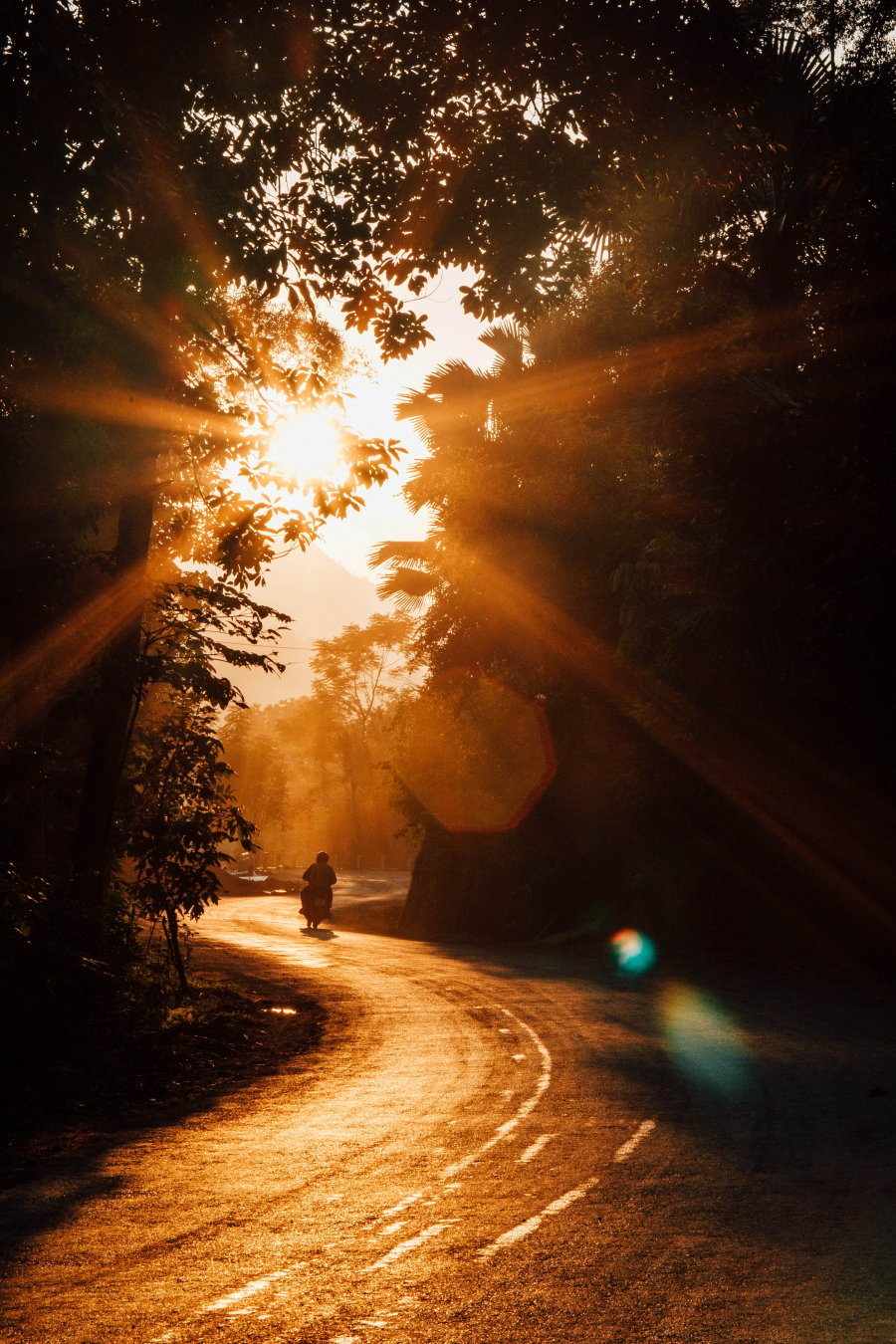
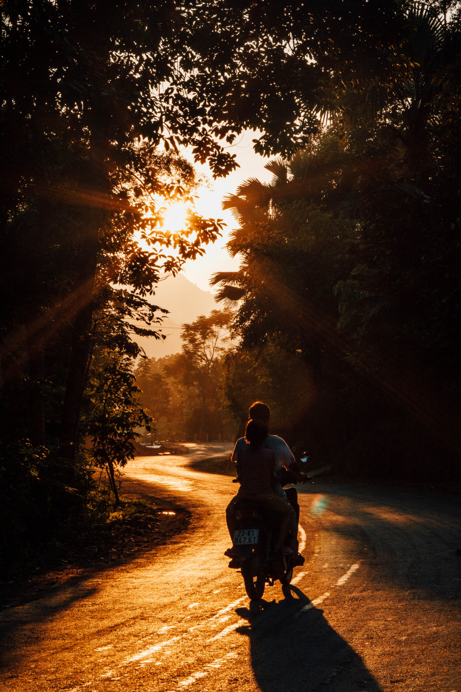
The distance from Moc Chau to Ta Xua isn't too long, only about 100km, separated by the Van Yen ferry crossing the Da River. Ta Xua commune has long been famous as a cloud-hunting paradise for travel enthusiasts and landscape photographers. The road from Bac Yen town to Ta Xua isn't difficult, but it presents many challenges for drivers. Due to climate and weather characteristics, cloud hunting in Ta Xua is generally more difficult than in winter. However, with a little luck, I was still able to wake up in Ta Xua to a sea of fluffy white clouds weaving across the mountains and forests.
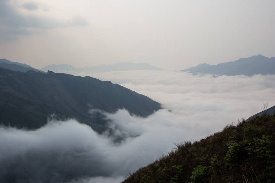
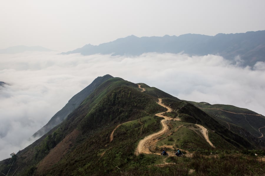
The best spot for cloud watching is the "dinosaur's spine" on the central road from Ta Xua to Hang Dong commune. Mother Nature has bestowed upon this place a truly unique "bridge" amidst the sea of clouds. Walking on the "dinosaur's spine," touching the thin, cool mist, feels like floating among the ethereal clouds.
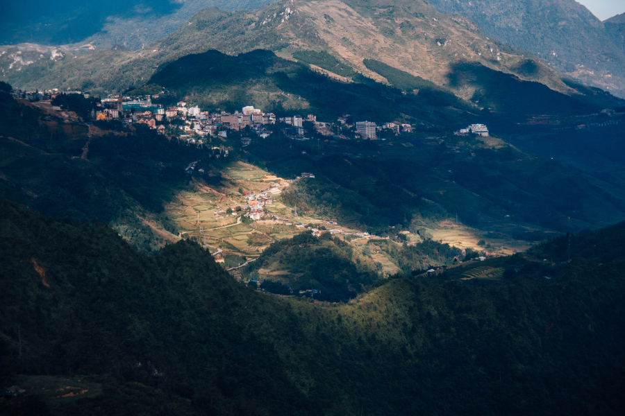
Sapa - Mu Cang Chai
Located just about 300 km from Hanoi via highway, Sapa's characteristic cool climate makes it the ideal destination for escaping the heat. For someone traveling by motorbike like I did, the best option would be to take a train to Lao Cai, then disembark and continue the remaining 35 km to Sapa town.
Upon arriving in Sapa, my first goal was to conquer the "Roof of Indochina" - Mount Fansipan (3,143 m high). To reach the Fansipan Legend cable car station, I traveled by elevated train that passed through the town and across the Muong Hoa Valley. Sitting on the cable car, I experienced the feeling of soaring amidst the clouds and mountains, with the lush green rice paddies of Muong Hoa Valley below, glimpses of simple thatched-roof houses, the ancient Hoang Lien Son primeval forest, and the towering, rugged mountains reaching thousands of meters high... Reaching the summit, my emotions surged as I stood in a heavenly paradise, surrounded by white clouds stretching to the horizon, and immersed in the sacred and serene atmosphere of the Bich Van Thien Tu pagoda complex.
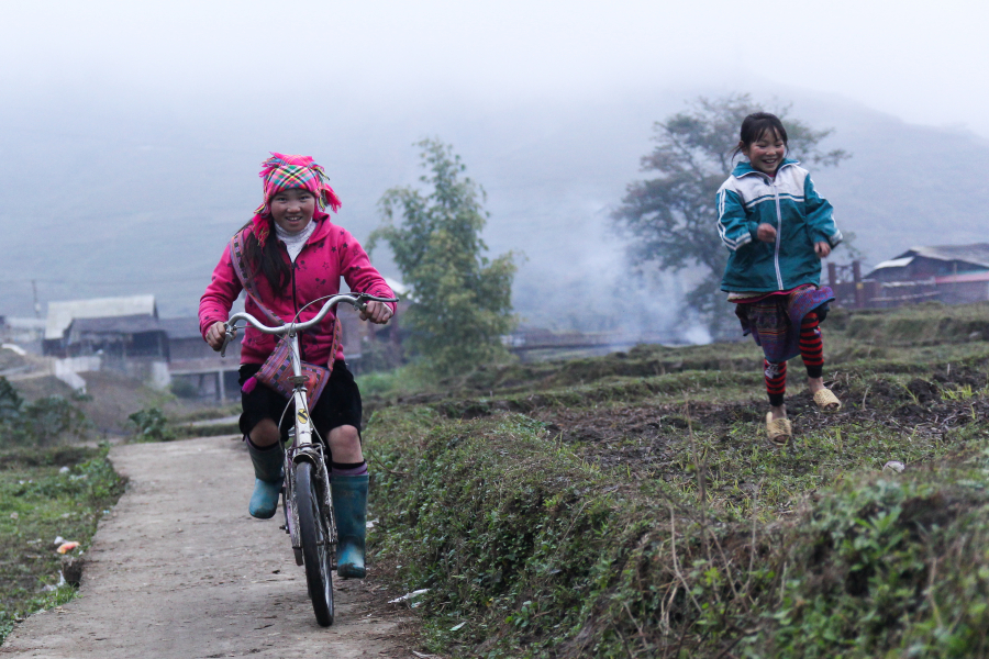
A little further from the town, I arrived at Cat Cat and Ta Van... ethnic minority villages nestled peacefully and rustically amidst the mountains and forests. Here, I immersed myself in the rich local culture, enjoyed a traditional herbal bath, ate thang co (a local stew), drank apple wine, and got acquainted with the friendly and simple ethnic minority people.
The journey from Sa Pa to Mu Cang Chai was a truly emotional one, especially with the opportunity to conquer the O Quy Ho Pass. This legendary pass, stretching across the Hoang Lien Son mountain range and connecting the provinces of Lao Cai and Lai Chau, is one of the most treacherous mountain passes in the North. The Than Uyen - Tan Uyen route along National Highway 32, on the other hand, boasts a poetic beauty with stretches of road running alongside the Da River, a hydroelectric lake with emerald green water, and colorful rice paddies.

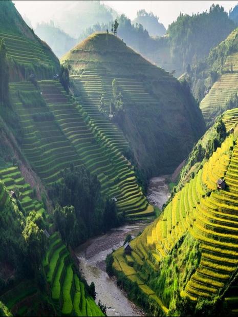
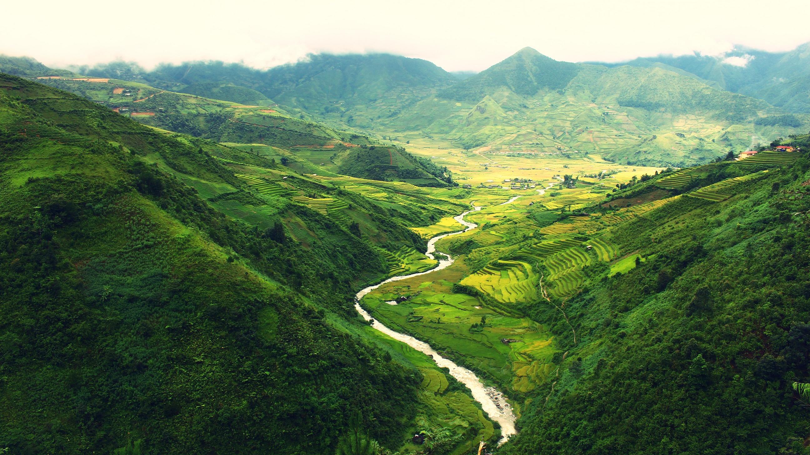
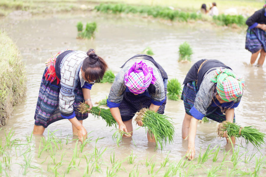
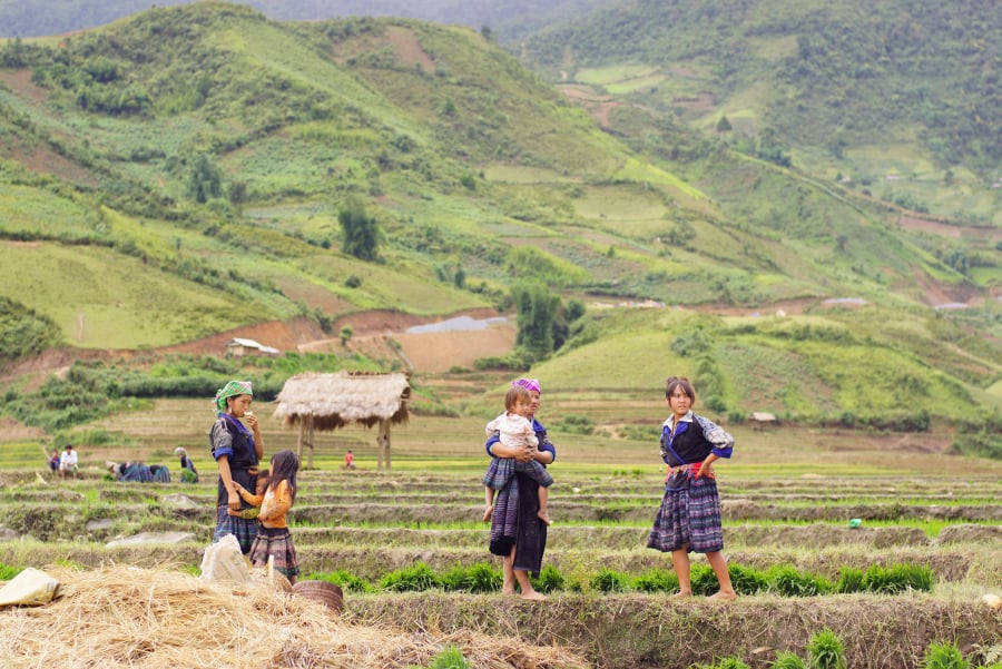
Every year in May and June, water from the mountains pours down, filling the terraced rice fields halfway up the mountain. During this time, taking advantage of the high water level, the ethnic people work together to plant rice. Layer upon layer of calm water reflects the golden afternoon sun, interspersed with a few figures bent over diligently sowing rice seedlings, creating a magnificent picture of nature and people unique to Mu Cang Chai. To fully experience the Northwest during the rainy season, I made my way to the famous Mam Xoi terraced rice fields in La Pan Tan commune, which has the largest area of terraced rice fields in the region. Chasing the sunset at the "horseshoe" terraced rice fields in San Nhu commune or watching the sunrise in Kim Noi, admiring the entire town of Mu Cang Chai in the early morning, are also unforgettable experiences.
Khau Pha Pass, meaning "Horn of Heaven" in Thai, is one of the four most treacherous mountain passes in Northwest Vietnam, but it's also a superb route to admire the beauty of Mu Cang Chai. Riding a motorbike through the mountains and clouds, letting my soul wander with the breeze and the cool air of the ancient forest, I felt truly free and peaceful.
A tour around Ha Giang
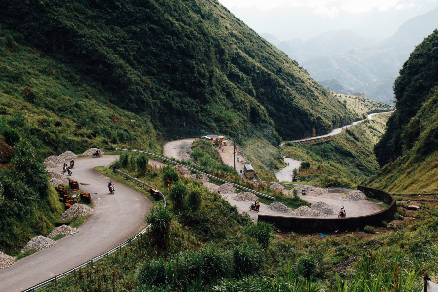
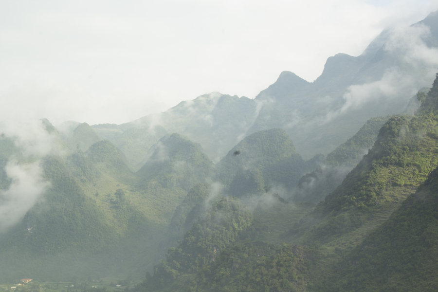
Along the route exploring the mountainous region of Northern Vietnam, one cannot help but think of Ha Giang, the northernmost point of the country. I chose the route from Ha Giang city - Quan Ba - Yen Minh - Dong Van - Meo Vac - Du Gia - Bac Me for this trip. From Hanoi, I took a sleeper bus to Ha Giang city and then rented a motorbike to begin exploring the rocky plateau. The first mountain leg was quite simple, the wheels rolling quickly past famous landmarks such as Quan Ba Heaven's Gate, Co Tien Twin Mountains, Yen Minh pine forest... However, due to limited weekend time, I only visited these places and couldn't fully appreciate the scenery along this stretch. Instead, I chose to spend most of my time exploring the Dong Van - Meo Vac - Du Gia leg.
DONG VAN
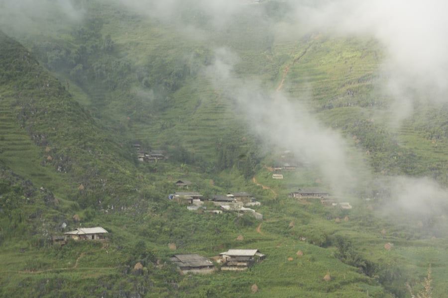
Located about 150 km from Ha Giang city, Dong Van district, along with three other districts – Quan Ba, Yen Minh, and Meo Vac – forms the Dong Van Karst Plateau Geopark, recognized by UNESCO as a Global Geopark. However, in terms of its characteristics, Dong Van is perhaps most distinctly characterized by its "rocky" nature. Sharp, jagged rocks jutting straight up into the sky appear throughout the roads of Dong Van, surrounding every branch and blade of grass, interspersed among houses and terraced rice fields. The people build their houses with stone, cultivate on stone, live with stone, and even lie buried among stone in their graves.
Nestled amidst the rocky landscape of Dong Van lies a small valley, perpetually lush with trees and flowers – Sung La. Against the backdrop of towering, dark mountains, Sung La stands out as vibrant and beautiful. The Hmong people of Sung La cultivate a variety of crops on the rocky terrain, from the bright pink and white buckwheat, to the dazzling peach blossoms of spring, and the golden yellow of mustard flowers. Because of this, Sung La is also known as the land where flowers bloom in the rocky mountains.
While Sung La emerged vibrant amidst the rocky plateau, the ancient town of Dong Van and Pho Bang town captivated me with their nostalgic, ancient beauty. The time-worn rammed-earth houses with tiled roofs, centuries-old wooden window frames, and the peaceful, tranquil atmosphere were what I found in these two places.
Along the way exploring the Dong Van Karst Plateau, I also experienced other extremely attractive places such as the Happiness Road, Tham Ma Pass, the Hmong King's Palace, and most notably, climbing nearly 400 stone steps of Dragon Mountain to reach the Lung Cu Flagpole - the northernmost point of the country. Standing on top of the flagpole, with the red flag with a yellow star fluttering in the border sky, you will feel how sacred the word "sovereignty" truly is.
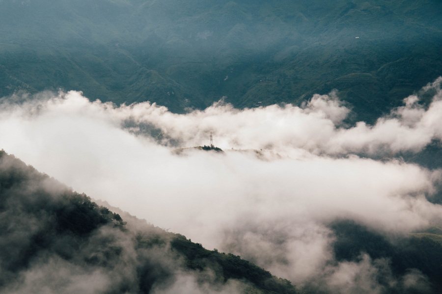
Many people have checked in at the Lung Cu Flagpole, but not everyone gets to experience cloud hunting there. Starting from Dong Van at 4 am, I arrived at the top of the flagpole before sunrise. As the first rays of sunlight appeared, ethereal mist and clouds gradually emerged, weaving through the Lo Lo Chai village and the houses of Then Pa. As the sun rose higher, a natural wall of clouds formed, clearly dividing the boundary between sky and earth. Above, the sun glowed a brilliant red, while below, the simple village was shrouded in the hazy smoke of cooking fires. Witnessing this magical moment, I believe I am one of the luckiest travelers on the rocky plateau.
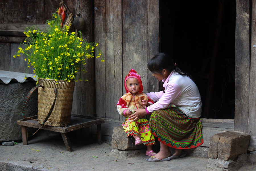
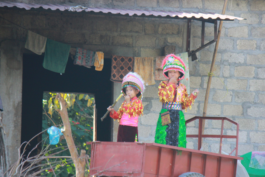
When visiting Lung Cu Flagpole, remember to stop by Lo Lo Chai village. The Lo Lo people here regularly organize rain-praying festivals, forest god worship ceremonies, and harvest celebration festivals... featuring traditional folk dances, and especially centuries-old bronze drums. Besides relying on farming for their livelihood, the villagers have now opened homestays to welcome tourists. Experiencing a night in Lo Lo Chai with the locals, enjoying traditional corn wine and unique local cuisine is truly a fun and memorable experience.
CAT
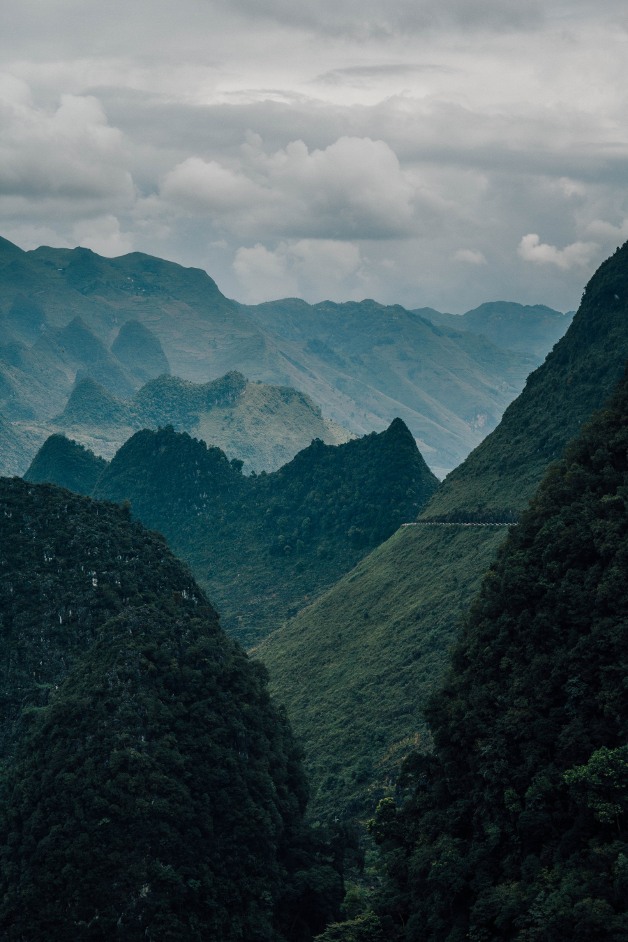
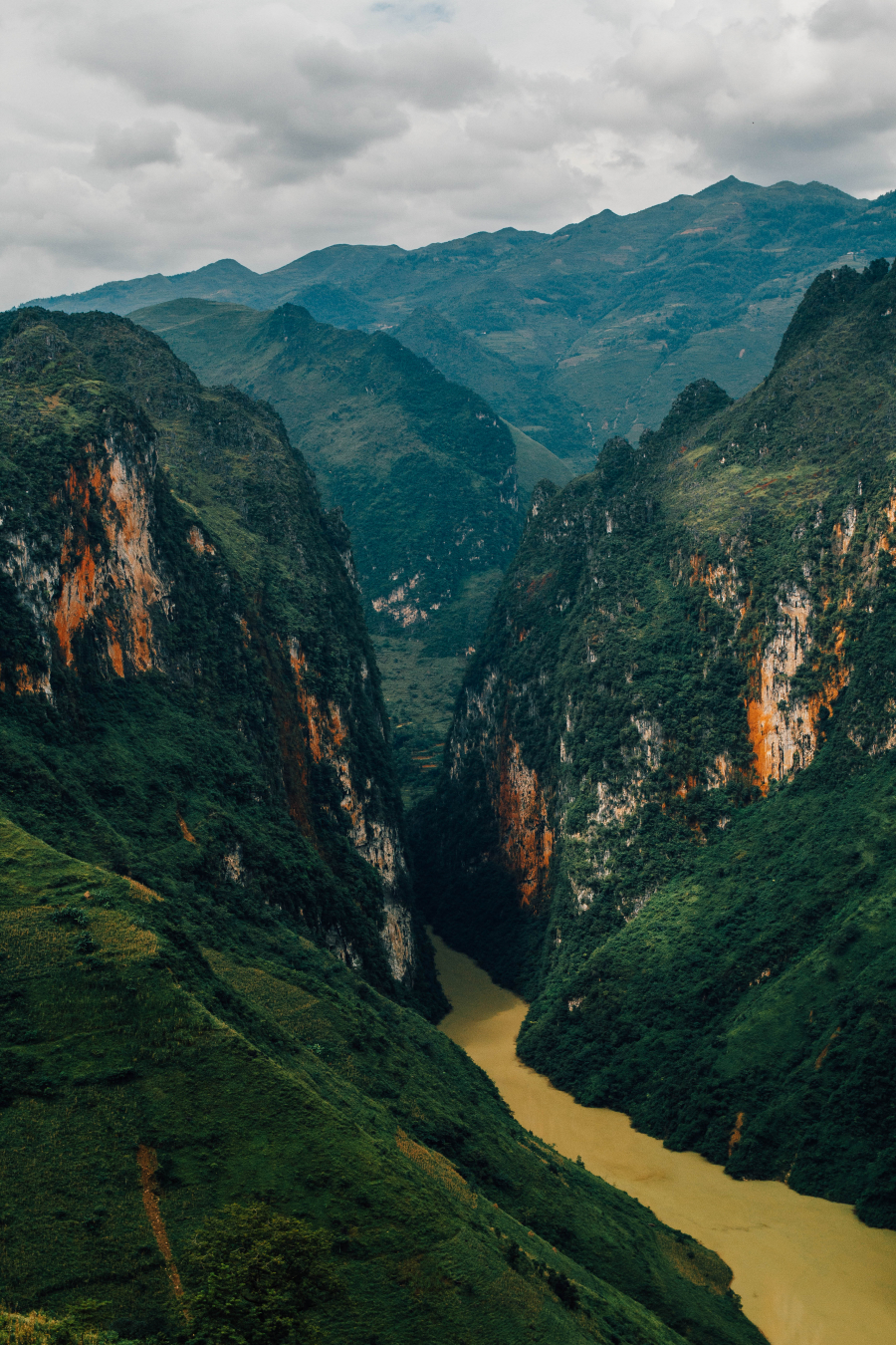
From Dong Van to Meo Vac, I traversed the most treacherous road in Vietnam – the Ma Pi Leng Pass. Standing on the summit of Ma Pi Leng Pass, over 2,000 meters high, gazing far into the distance to take in the vast expanse of clouds, sky, wind, and mountains, I truly felt the grandeur of nature, overwhelmed by the majestic natural landscape of this harsh mountainous region.
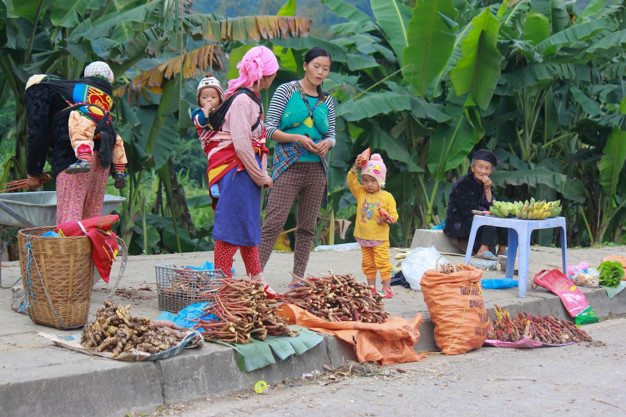
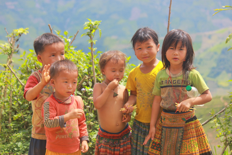
While Dong Van is famous for its small towns and ancient relics, Meo Vac is a melting pot of unique cultures of ethnic minorities, most notably its vibrant fairs. Visiting Meo Vac in the summer, I was immersed in the bustling atmosphere of the markets... Besides buying a few souvenirs, I also enjoyed the specialties of the Dao and Mong people, such as Meo Vac mint honey, grilled moss, and braised pork belly...
YOGA
After passing through Meo Vac, instead of returning to Yen Minh road, I chose to continue towards Du Gia - Mau Due before heading back to the city.
After a night's rest, I woke up early with the goal of chasing clouds at Gió Pass, the mountain pass connecting Du Già and Lũng Hồ town, clinging precariously to the rocky mountains like a thin thread. At dawn, the pass was shrouded in mist and clouds, forcing me to find a high hill to get a panoramic view of the landscape emerging from the cloud cover. While the clouds at Lũng Cú are neatly contained within the valley, those at Gió Pass blanket the mountain peaks and roads, stretching endlessly. Combined with the slanted morning sun, the sky and land beneath the clouds appear shimmering and magical. Perhaps few words can adequately describe this beauty!
Continuing along the Wind Pass, heading back towards Lung Ho, I felt like I was floating in paradise, with only wind, clouds, and my small car rolling along the winding mountain road. My cloud-hunting journey ended when I reached Lung Ho, a small town surrounded by pristine mountains. Despite this, life here was incredibly lively and bustling. Luckily, arriving on a Sunday, I got to experience the fascinating weekend market.
Afterward, I didn't forget to return to Du Gia, where there's another incredibly attractive spot: Tham Luong Waterfall. To reach the waterfall, you absolutely need a local guide and have to walk across fields and strangely shaped rock formations... The waterfall is small, with only one tier about 4 meters high, but don't underestimate it because the pool at the foot of the waterfall is nearly 3 meters deep in some sections. There's nothing better than relaxing in the cool water after a long journey exploring Ha Giang. I even borrowed swimming goggles from the Hmong children to catch fish in the crystal-clear water, chasing after schools of small fish swimming around – it was truly enjoyable.
With its pristine and diverse mountainous landscapes, and a blend of diverse ethnic minority cultures, the northern mountainous region of Vietnam has always been an attractive destination for both domestic and international tourists. For those who love nature and want to freely immerse themselves in the clouds, wind, and mountains, conquering these routes will surely be a magical experience during the sunny summer.
Preparing for a journey on two wheels:
- Plan a reasonable itinerary, including identifying the most basic information such as landmarks, routes, accommodation, and places to eat... Everything should be detailed, concise, and easy to remember.
- Follow proper motorcycle maintenance procedures, especially regarding regular oil changes, tire and tube checks, and brake checks, before setting off. If you're traveling alone, equip yourself with basic motorcycle repair skills.
- Prepare your belongings, protective gear, and personal items. The best protective gear should be specialized protective clothing for long trips and a good quality helmet. Keep your belongings as minimal as possible, including a raincoat, a first-aid kit, and tools for repairing your vehicle.
- In addition, prepare brightly colored clothing. This will help keep you safer when traveling on the road.